-
Announcement
-

Simtropolis Returns! 05/26/2026
See here for details about our site recovery efforts.
-
Search the Community
Showing results for tags 'arizona'.
Found 19 results
-
Version 1.0.0
377 Downloads
Back with a new series of maps! This time we're bringing Sin City to SimCity, it's Las Vegas, Nevada, USA (for SimCity 4). The map is 24 x 28 large city tiles and is accurately scaled based on DEM data. Elevations have been adjusted slightly to include game water. The map includes cities, areas and landmarks such as: The entirety of Las Vegas city proper North Las Vegas Henderson Red Rock Canyon National Conservation Area Valley of Fire State Park most of Lake Mead including the areas around Hoover Dam parts of the Nevada/Arizona border In order to install the map you will need wouanagaine's mapper or terraformer as the file is in SC4M format. I hope you can put this map to good use, and remember, what happens on this map... stays on this map... -TCC View My Full Map Catalogue Here: -
Version 1.0
250 Downloads
Description I made this while learning how to create SC4 regions using high resolution heightmap data from real world locations. This is most of the Grand Canyon, USA. I think it came out pretty good, and decided to share it. I did a little extra tweaking to make sure the river runs all the way through the canyon. It's not 100% accurate, but close enough. And making sure the region has enough buildable surface in every city square. There's 20 Big, 16 Medium, and 8 Small city squares. For a total of 44. I made sure there is varying levels of landscape to build on. With some being relatively flat and easy, and others not so much. Installation The file is in SC4M format. So you will need SC4 Mapper to install. Enjoy! -

From the album Cities in Microsoft Flight Simulator
-
Welcome to the town of Desona, Arizona... A beautiful West American town located among the red rocks of Arizona, approximately 80 miles from the New Mexico, Utah and Colorado state borders. A mix of classic American architecture as well as modern developments. New builds now available for purchase... (Unfortunately my old save had issues with concrete and props disappearing upon loading so had to abandon it and think the new Sedona map from Ronyx looks amazing. So we'll see how this goes. With over 10,000 assets I'm hoping for a mixed build if I keep up with it!)
-
Greetings everyone! I have been working on this project off and on due to college (finally graduated from the University of Arizona ). Thankfully many parts of town are near finished, although it is a very long way to go to complete the entire valley. I have started working on the Catalina Mountains and Foothills. Although it will be some time before I start adding buildings in this area. Tucson Mall on the north side is done. As is El Con Mall in midtown. (Before it was gutted.) Pima Air and Space Museum. Davis Monthan AFB. And lastly, the Boneyard.
-

Entry III - Residential Development
TheHaso2011 posted a City Journal entry in Phoenix, Arizona - A recreation attempt
This entry is going to be fairly brief, as I haven't found much time to develop anything specifically new, so is mostly just a repeat of the previous entry. This time I have developed the residential area north-west of the mini stack interchange. The design is similar to the area south of I-10, but the amount of industry is slightly toned down, with mid-wealth residential and commercial services taking a larger role. Above is a small residential square cornered by E Palm Ln on the north side, N 18th St to the west, N 20th St to the north and E McDowell Rd to the south. The other feature that breaks up the grid pattern is the bow shaped street formed by N Whittier Dr which meets E Granada Rd to the north and E Almeria Rd to the south at their respective intersections with N 16th St. I may return later to N 16th St due to its width. Here is is picture as being 6 lanes wide, but the real life version is only 4. Above is an image of the reduced industry seen in this area of development. Most of the industry here appears along E McDowell Rd and N 16th St, mixing in with the commercial services available. Finally, some work I attempted on the mini-stack interchange. I'm getting to the point on this where I think I am going to use my free will to modify the interchange to actually work, instead of trying to make it as realistic as possible. The main problem at the moment is the flex-fly fun I{m having at the top of the image, but I think I may have a solution to that. Something to note before I leave, I have changed the texture pack, so I am now using CPT Painted Desert Terrain Mod, which I hope will give a slightly more realistic appearance to the general map. -
Entry II - Industrial + I-10 Development
TheHaso2011 posted a City Journal entry in Phoenix, Arizona - A recreation attempt
So Entry II. Since Wednesday I've made considerable progress on I-10 heading south, pretty much reaching the outer expanse of the city. Further to this, I began small amounts of zoning near the Mini'stack interchange which I developed slightly but have yet to complete. Anyway, pictures! I'll start with the zoning development I have begun just North-West of the airport, between I-10 and 16th Street. The image at the top is just some generic industry just off the I-10, sandwiched between E Washington St and E Jefferson St. Looking closer now at the map, each one is in fact one-way so I will likely revisit this later and alter accordingly. The next image is of the residential area that has developed to the north of the industry. I have tried to 'overlap' the industry and residential as much as possible, so many of the areas to the south are a mixture of residential streets and industrial roads, as seen in the second image. Just on the north side of E Washington St I managed to achieve a nice mix of commercial and residential, along with a short woodland path as a divider. Finally, an overview of the current development on that tile, cornered in by I-10 and the Mini-stack. The overview really shows the extent of the industry mixing with the residential. Moving south, I have now fully developed the UPS Car Park to the south west of Runway 08. It really fills in the gap between 24th St and I-10. That covers the extent of construction throughout the city so far, so now on to the progress I made on I-10 heading south out of the city. The progress covers three tiles, so the images below will simply be highlights of the better interchanges. This first interchange is the junction between I-10 and Route 143 (seen at the top) and the junction of I-10 with W Broadway Rd. There are some slight modifications due to proportions but overall I think it turned out quite nicely. Finally, here is the interchanges between I-10 and Route 60, which I am very pleased with. Although it is not an exact replica, it comes pretty close to it and it is possibly the most satisfying junction I have built with the RHW. The junction with S Priest Dr can also be seen at the bottom of the image. As per usual I will wrap up this entry with an overview of the progress made so far. We have currently established 5 tiles, covering the area between the Mini-stack interchange and going right down to Chandler Blvd and the area where the city ends. As always, thanks for reading. Be sure to comment any opinions or criticisms you may have, I'll try my best to address them.-
- 8
-

-
- industry
- residential
- (and 4 more)
-
Welcome back to Winton, ready to begin the new 20th century? I can't wait to see the technological ideals arising, and to rise. Maybe more trains, and transportation, heck even maybe horses made of gears! It'll help out at the corral that's for sure. We do as the new year begins for us, have a new landmark for our little town. Welcome back, we see the general store and such at night lit up along Goodwin St. People gathering at the courthouse for a New Years celebration. Inside a band will be playing, food, and all in the first floor! Square Dancing, and so much more. All is welcomed! Free of charge! The neighborhoods are quiet, people are gathering at the courthouse, to see the quiet small streets like Broadmoor street here in its fine beauty. The school is also planting a small community garden, wish them luck in our climate; but it teaches the kids about real outdoorsy skills, and them not stuck inside on their washboards and guitars. This is the future, all of us outside, having a fun time! Now for the big landmark we were talking about! Which is named the, Alan Coleman Gazebo, after Doctor Alan Coleman, who was the town doctor till 1899 when he died at the age of 74. A great doctor he was, we miss him much in our town. We'll see you all in 1903.
-

Tucson, Arizona. (work in progress)
zomo771 posted a City Journal entry in Tucson, Arizona. (Work in Progress)
I am recreating my hometown of Tucson, Arizona. I am trying to make it as close to real life (within Sim City 4's limitations) as possible including road distances, mountains, and landmarks. So far I have mostly completed some areas including downtown, University of Arizona, South Tucson, El Con Mall, part of Davis Monthan Air Force Base, and other parts of the north and south side of town. -
Version 1.0
1,289 Downloads
This is a southwest desert flora pack. Included in this pack are the four files: Arizona Desert Flora Desert Scrub Brush (essentially revamped maxis scrub, thinned out) Eastern California Desert Flora Mojave Desert Flora Credit goes out to the BSC team and C.P. for the incredible desert models. Listing of included trees/cactus/shrubs/plants: Arizona Flora: Desert Scrub, Brittlebush, Ocotillo, Mesquite, Palo Verde, Saguaro and Organ Pipe Cactus Desert Scrub: Desert Scrub, Dead Scrub Brush and Mesquite Eastern California Desert Flora: Desert Scrub, Brittlebush, Ocotillo, Mesquite, Yucca and Barrel Cactus Mojave Desert Flora: Desert Scrub, Brittlebush, Yucca and Joshua Tree Required Dependencies: BSC MEGA Props CP Vol 02 https://www.sc4devotion.com/csxlex/lex_filedesc.php?lotGET=2790 Seasonal Flora Patch for All Terrain Mods https://www.sc4devotion.com/csxlex/lex_filedesc.php?lotGET=2612 -
Version 1.1
793 Downloads
Well here goes it this is my first mod. I couldn't find the desert mod I was looking for so I decided to learn how to create my own. This mayor mode brush is a specific recreation of the Arizona desert flora. These high quality models used in this mod are credited to C.P. and the BSC team. A few maxis scrub files were also used as well. This is semi seasonal mod very similar to the original MMP Semi Seasonal Desert mod minus the trees that don't pertain to Arizona. Required Dependencies:. BSC MEGA Props CP Vol 02 https://www.sc4devotion.com/csxlex/lex_filedesc.php?lotGET=2790 Seasonal Flora Patch for All Terrain Mods https://www.sc4devotion.com/csxlex/lex_filedesc.php?lotGET=2612 -
@HighTower76: Thank you! Although admittedly, Phoenix's grid network mostly laid it out for me @TekindusT: I've been following Tenements & Rust since before I left 2 years ago, and it was part of my inspiration to create my early attempts at CJ's, so that means a lot to me! @Durfsurn: Absolutely. As Compdude suggested, I'll probably just rearrange some tiles wherever it is needed, since I'd rather not sacrifice too much accuracy. As for the lack of BATs, I'm planning on trying to BAT a few things myself (Hopefully some people can help me out there), but mostly I'll just substitute similar-looking buildings in their place. @dlsni: Trying my best not to die, but it's quite difficult at times This project may be crazy, but it's a good kind of crazy. @elavery: Yes, I do plan to try BATing some of the more famous buildings (ie US Airways Center, Chase Field, Biltmore Hotel, etc), although I know a half-finished Cardinals Stadium is floating around sc4devotion... @fan o SC4: Thanks, I'll need it. @tonyr: I'm not sure where it will go myself. I'd expect it to span a couple years, if I don't lose inspiration... @Tonraq: Thanks! Laying out roads is more difficult than you'd think... @PhatHead: You just wait, there's much more to come @Schriefer: As am I. @jmsepe: Hopefully I can stay motivated / focused to see it to completion. What with school though, I'm not sure @CompDude787: I didn't even take the population factor into consideration. It should be fun to see how over-the-top it turns out to be. And yes, I think I'll have rearrange the city tiles like you said. The main reason I was avoiding it was because it would make my region management job more difficult. And luckily I don't have to worry about your Seattle problem: 14-lane HOV highways with exits every mile running through downtown. And we don't have nearly the density that Seattle does, so that helps a lot. @rewright: It is quite an undertaking. I guess I'll have to regulate my attention to detail, because otherwise I'll never get this project done. ~~~~~~~~~~~~~~~~~~~~~~~~~~~~~~~~~~~~~~~~ ... ... ...aaaaaaand I've officially no longer a one-update wonder! You heard me right. I managed to design the entire downtown road network without dying. Now, let's see what I've done to said road network: Here we have our region view. As you can see, downtown is still a bit of a loner, but we'll fix that soon. Let's get closer in: We'll start off by exploring the outskirts of downtown before entering the heart of the storm. Here's the very industrial south side: As indicated, this area is a mild ghetto. You'd probably be safe walking the streets, but it's still not a good place to be alone. Enjoy that nice smooth highway for now, because I-10 is a whole different monster that I'll have to tackle in another update. This area is more what I call a "historic ghetto," in that this area is home to the earliest industrial centers that drove Phoenix's growth. As you'd expect, a railroad track (the Union Pacific Railroad) runs conveniently through this area. At the top of the picture, you can see a pretty good sign of where industry turns to commercial as roads get nicer and curvier. Phoenix has a bit of a "other side of the tracks" situation going on. For reference, the horizontally-running TLA-5 at the bottom of the picture is the same road as the one running along the top of the previous picture. Now we enter the west side. West Phoenix has a bit of a strange identity crisis going on, as its north half becomes extremely residential while its bottom half remains heavily industrial. Also, living conditions are slightly better here than those shown in the previous two pictures. As noted, you can see the terminus of Grand Avenue in the center of this picture. Grand Avenue will become an incredibly important road later on as it turns into US 60, which services much of The Valley. For reference, the pair of horizontally-running one-way roads at the bottom of the picture are the same ones running through the top of the previous. Now then, let's stop avoiding it and plunge straight in to the center, shall we? Here's downtown: Yes, it's a downer of a city center in comparison to most US cities, but it's nice nonetheless (It will be much better with buildings). Also, it's a little lonely right now thanks to the lack of a light rail system. Unfortunately, I can't install a light rail system with the current NAM limitations (maybe if we get single-track light rails). I'll go a lot further in-depth on my temporary solutions to the lack of light rail pieces in the next update. Also, just for fun, I decided to try putting labels onto each of the roads for reference sake. The results weren't half bad: All right. If you're familiar with the Phoenix area, you probably know why I've been avoiding the north side of downtown. Here's a hint: A certain highway runs through there. Well, let's take a look: Whew. You can't look at that without cringing. While I-17 is nice, flowing and easy to control (It also helps that it's a 6C highway most of the way), I-10 is... not. It is a 12-lane highway for the most part through downtown, though some stretches are 14-lane. The RHW in its current form, of course, cannot handle this, so I had to do a workaround. It doesn't help that the exit style used in Phoenix is slightly modified from a standard diamond, in that all 4 paths intersect in one spot in the middle. As you may imagine, SimCity cannot handle this in a pretty way. For now, the exits will be left as these kinds of ugly heaps until I can work out a better way to present them. Also, see the section I circled? Yep, apparently 5S lane shift pieces don't exist. So that was my temporary solution to having to move the highway down one tile. I'll go back in and redo several stretches of this highway when I muster the courage. But wait, there's more. Come visit Northwest Downtown... Yes, that picture at the top is the actual exit. If FARRHW pieces could work that smoothly in-game, I'd be set. Alas, they do not, and I'm stuck with this monstrosity. Oh well... So what's next on my to-do list besides ripping my hair out over RHW? Well, let's visit Eastern Downtown... In the center of this picture you can see my early feeble attempts at designing the Phoenix Railyard. Just so you know, the yard takes up the entirety of that empty patch in the middle of the picture. Looks like I'll need to break out some plugins to make it look right. Finally, the last thing I need to do is begin my hunt to find buildings that fit into the Phoenix style. Hopefully my search won't be in vain... ~~~~~~~ Before I end, I ask you all to respond to a little poll: How do you think I should post my future updates? My options are either to break updates into smaller chunks, and focus on one section of a city tile at a time, or I could continue doing these mass updates that show a ton of progress but are very slow to get out (and when school starts in 2 weeks, they will be much slower to get out). Let me know what you think. For now, I'll set my main focus on the railyard and fixing the highway system in North Downtown. See you soon! -Samness
-
Hello and welcome to the beautiful city of Phoenix, Arizona! You are reading the first entry of a journal that is likely to be my demise. I plan to construct the entire metropolitan area as faithfully as possible. And that is a very large metropolitan area, as you'll soon realize. To start off, here are some fun facts about the city: Phoenix is the most populous US state capitol and the 6th most populous US city, containing over 1.5 million people. That number increases to 3.6 million with the addition of the surrounding urban areas. There are a total of 4.3 million people in the Phoenix-Mesa-Glendale Metropolitan Statistical Area, which is defined as Maricopa and Pinal counties (the two counties in which Phoenix resides). The city itself makes up 518 sq mi (1,338 sq km), with a density of 2,798 people/sq mi (1,080/sq km). Phoenix was settled in 1867, and has since grown rapidly. For the last 40 years, the growth rate has been nearly 4% per year. At this rate, the city is predicted to rank 4th in population by 2020. Well, that was boring. Don't worry, you can all wake up now; It's fun stuff from here on out. Today's update is focused on one thing only: Planning. After looking for a suitable region map for me to use, I settled on drunkapple's Phoenix Scale Map (thanks mate), which consists of 396 large tiles. In order to take on the challenge that a region this size presents me with, I knew that I would need to make up a very large plan of my whole network and layout. So, I found a top-down view of the region and used GIMP to place it on top of a Google map of Phoenix, and then redrew all of the city boundaries. I also started to give names to each city tile, for use in-game later on. In the end, this is the fruit of my labor: Note that every red square is a large city tile. Also, see that red rectangle at the top of the picture? This file has 282 layers (most of them are just text), and contains 12724x7891 pixels (My computer definitely had a good time with that). You should also notice that the region doesn't cover a few areas of city (Like Apache Junction, downtown Buckeye, New River, Morristown, San Tan Valley, and some of eastern Queen Creek/Mesa). However, that isn't too big of a deal, considering how much I have on my plate already (Besides, you could argue that since Apache Junction is in a different county, it isn't really part of the metro area). Besides the minor flaw mentioned above, there is one bigger and much more annoying problem: The gridlines. Since the game's city boundaries aren't designed around its cities, there are a few places where some unfortunate placement of boundaries will cause me many problems in this project. Here are two examples (both are interchanges): Yep, each of those interchanges will be located in at least 3 city tiles. Not to mention that on the bottom picture, Interstate 10 is cut straight down the middle by the border. Looks like I'll have to move some roads around a bit, or else face some serious headaches. Oh well... Well, that's about all there is to show for planning. Now it's time to get into the game itself and start working. Obviously, I'll need to start with the road networks. But we'll save that for the next update. For now, stay tuned. See you soon!! -Samness
-
Version 1.0
1,179 Downloads
G'Day Simtropians, Thanks for not forgetting me, so I thought what about a little celebratory map! This I made about 4 years ago and decided at the time not to release it as CP also has a map on the lex of the Grand Canyon. Tonight I thought what the heck for those who do not frequent sc4d, here she is. The Grand Canyon is situated in Arizona and is about 17 million years old, although the Colorado River has carved out about 2 billion years of geological history of our beautiful Earth in that time. A mighty effort all round I should think. Of course this is an accurate scale map prepared with dem data. It's in sc4m format so one will need wouanagaine's mapper or terraformer, links and further instructions are in the zip. That's all folks Cheers drunk- 14 Comments
- 22 Reviews
-
- 3
-
-
- map
- accurate scale map
- (and 7 more)
-
Version 1.0
164 Downloads
G'Day Simtropians, Today I am presenting a map requested courtesy of Phxgreenfire, thanks mate. Tségháhoodzání is also known as Window Rock for the large formation with a hole in it and is located in Arizona. See me up CLOSE and personal. This is a real world map and is accurate in terrain and scale. It measures 49.152km x 45.056km and requires Wouanagaine's mapper or terraformer to import it into SC4. The map was produced with dem data. A readme is included containing links and instructions and a pic and is free. That I think is about all. Cheers -
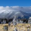
Showing Off Before I get to other business, a few folks asked me to show off a few more pictures of my trip to Arizona. So, a representative sampling of the journey will be shown below. With of course some SC4 stuff in it to stay legit. Let the games begin! First, I must leave my palatial estate to meet my throng of followers down at Simtropolis Park. Why not come along for the ride? Resized to 79% (was 1024 x 819) - Click image to enlarge Plenty of available parking today… I wonder who will be coming by to see the pictures. I am setting up at one of the market stalls to do my slideshow. Come on over! I am starting now! Arizona Hwy 89A through the Oak Creek Canyon… it is even windier than the picture indicates… and those are switchbacks, not curlicues. A view of the intrepid Grand Canyon Another view of the Grand Canyon… several miles further down the road. You guessed it… the Grand Canyon! It sure is big! The Holy Grail of license plates! For those who enjoy trying to get all 50 states in a road trip, this is the hardest of them all. You would think Alaska and Hawaii, but I have seen double digits of those in the past year alone. It has been so long since I have seen a ND I forgot what they looked like. And, Craig, I vicariously add you to this trip so you can check it off on your list! Sunset at the canyon… Meteor Crater, not far off of I-40 between Flagstaff and Winslow, Arizona. Monument Valley, on the Navajo Reservation. Lots of cool rock formations like this one… And these! A tumbleweed! I think we were too amused over these. Got to see some actually tumbling… Treasure this one… it was a long and dusty ride out to Four Corners… the only such place in the US. Only one place can beat it: Now here’s a rare treat… a bald eagle sitting on its nest. How often do you see this? This was long the Verde Canyon Railroad line. The coolest cacti ever. I think I was overly amused by these guys too. I love how they just hold their arms up like they’re in a bank robbery. That’s the end of the show… hope you enjoyed it. And now, back to the parking lot. And now back to the secret factory where I make all of the Schulmania updates… see ya soon!
-

McDonald's Invitational: International Simtropolis Challenge
Schulmanator posted a City Journal entry in Schulmania
The Ultimate Challenge: International McDonald’s Invitational On my recent trip to Arizona, I saw something I had never seen before. I have been to 17 countries and never seen this variant before. I spoke with others who have been to other countries… over forty in all. And this is the only instance of such a thing we know of ever happening. So, I will show you (of course!) and then issue the ultimate Simtropolis challenge to you. From a distance, you notice nothing different… or do you? Typical suburban commercial area… or is it Yep, this looks like a pretty typical McDonald’s. So, where does the challenge come in? In Sedona, Arizona we saw a McDonald’s unlike any other. When you consider how many different McDonald’s emporia I have seen over the years over three continents (plus many more seen by the people I polled… covering all 6 inhabited continents), no one had ever seen something like this. This particular restaurant was startling not for its menu (the same as you get everywhere) but for the décor. This is the only instance I have ever heard of when the venerable Golden Arches are not golden. Yes, that’s right, NOT golden! Here’s the evidence: Notice anything different? Look closer… the trademark “M” is not yellow… it is turquoise! No one I know has ever seen a non-golden “M” at one of their places. So, I present it to you as a challenge. I challenge anyone out there who has seen a non-golden arched McDonald’s to post a picture of it. I have to think this is not unique on earth, but it has to be rare. So, you are challenged to one of the challenges below: 1) Your picture of an unorthodox “M” McDonald’s (different color, different style, etc.) 2) Or, your picture of a McDonald’s you have seen you think is interesting. (I have seen converted W2W buildings, converted old buildings, and all sorts of interesting ones. Do you have an interesting one near you?) So now, the Simtropolis International McDonald’s Invitational begins! -
SchulmArizona!! Welcome to MTV's Spring Break... live from Northern Arizona! We have a special treat for you... some pictures taken in Sedona, home of the red rocks. Here, the red rocks are free... coyotes and roadrunners sold separately [additional coyote accessories available from Acme for an additional charge]. Enjoy a few pix taken by yours truly! Hope you like them. If you are all good boys and girls, I will give you some more pix soon! Meep Meep! http://www.revolverm...olor=a00000&m=1
-
Version 1.0
809 Downloads
G'Day Simtropians, Today's map I am presenting is courtesy of a request from RageDownRodeo here at simtrop. Thanks mate. It is of Phoenix Arizona including Cave Creek, Carefree, Fountain Hills, Apache Junction, Queen Creek,Salt River [dry], South Mountain, Buckeye, White Tank Mountains, AguaFria River [dry], and Anthem. See me up CLOSE and personal. This is a real world map and measures 90.112km x 73.728km, it is terrain and scale accurate. Using 16bit map tech it's in .SC4M format and Wouanagaine's mapper is required to import it into one's game. A readme is included with links and instructions. I think that's all. Cheers