-
Announcement
-

Simtropolis Returns! 05/26/2026
See here for details about our site recovery efforts.
-
Search the Community
Showing results for tags 'amsterdam'.
Found 28 results
-
Version 1.0.0
315 Downloads
Another week, another map, this time it's Amsterdam, The Netherlands (for SimCity 4). It is the capital and largest city of the Netherlands with a metropolitan area population of approximately 1.4 million. The map is 12 x 12 large city tiles and is accurately scaled based on DEM data. It has been rotated 30' degrees. In order to install the map you will need wouanagaine's mapper or terraformer as the file is in SC4M format. I hope you can put this map to good use, enjoy! -TCC View My Full Map Catalogue Here:- 1 Review
-
- 10
-

-

-
- thecitiescenter
- tcc maps
- (and 8 more)
-
Hello, Amsterdam is the world's best walkable city out there. It's so good that an emerging urban YouTuber, Not Just Bikes, praises the city so hard. But why don't we make auto-oriented cities instead? They're inefficient & unsafe. The culprit is the stroads. Strong Towns has made a video about it. Stroads are just like Windows 2-in-1s. They can't cater to pedestrian traffic safely and surprisingly not too accommodating cars since the speed limit isn't that high (only 50-60 km/h). They tried to have unlimited access and they did, except with much higher crash rate due to lots of conflict points. Adding insult to injury, cars need parking lots that steal the valuable space out from the city. Another concern is you'll hit a point that there are more cars than you predict when you need to expand the lane aka induced demand problem. While other transit do have the problem, the limit is way higher than cars. They're not great in terms of wealth generation. Due to that inefficiency, dense development is a bit difficult and the city only gets smaller taxes than traditional development counterparts. Not accommodating pedestrian is also worsen the situation. They're causing environmental destruction. It's obvious that ICE produces CO2 which isn't great in the age of ever increasing urban heat and worse, climate change. Even if you have electric cars, you still produce noise. Not Just Bikes (again) made a video about it: That's why I made Amsteroidam, Amsterdam on steroids. It features hi-rise buildings instead. It was going to be slated in a YouTube video. But I was unprepared in terms of YouTube so I cancel the plan. We start at the road structure. First, we have a freeway goes into an industrial city. Unfortunately, we can't transition to a street, so I made a stroad. We have a 2x3 commercial row and 3x2 and 4x2 residential row in the front. In the middle, we have a residential block with 3x2 and 4x2 lots. In the back, we repeat what we have in the front. What makes it a feat of urban planning is there are tram stations in every single horizontal street. So, you don't have to worry about public transit. Why we choose trams? Because it's like bus but it doesn't need a charge. What about the congestion? Well, there are some but mostly caused by cars. We have streets with 10K+ tram traffic and those streets aren't clogged up. We have 500K pedestrian & tram traffic and 150K car traffic. To be simple, we made a formula that pedestrian traffic = tram traffic. With the formula in mind, the total of traffic is 650K. If my math is right, cars contribute 20% to the city traffic. Who said public transit isn't profitable? We have made 13K in revenue and with 2K of building maintenance, so 11K in profit. I have some transport related ordinances so my city is bleeding 2K every month. But I don't care as long as my citizens use trams. In conclusion, you may not follow my city grid, but please make pedestrian focused cities. They're safer, quieter, healthier, etc. This is just a proof of concept. I hope this is useful. Let me know your opinion down below. Thanks.
-
I don't know if this is the correct sub forum to post in and please correct me when I am wrong But, Today I came across a youtube video of someone who made the city of Amsterdam in CS Although I don't play CS myself (I'm a SC4 fan) I still wanted to share this with you
-
- 1 Review
-
- 13
-
-
-
- leliegracht
- amsterdam
- (and 8 more)
-
- 2 Reviews
-
- 19
-
-
-
- kloveniersburgwal
- amsterdam
- (and 7 more)
-

Amsterdam - a public transportation heaven
RipRap posted a gallery image in The Transit and Aviation Geeks Club's Images

From the album Adventures
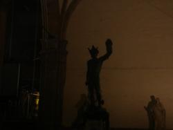
Amsterdam is one of the best cities in terms of choices of public transportation. The city is quite compact for walking, there are built cycle paths for bicycles and the tram adds convenience and charm to the city. I want to come back again...© 2016-2017 Tonraq
- 5 Comments
-
- 5
-
-
- amsterdam
- netherlands
- (and 3 more)
-
-

Nieuwezee - a tour of the town...
dazflint posted a City Journal entry in Nieuwezee - Noord-Holland Polder Town
Let's start our tour close to the historic centre of town, where the impressive Town Hall sits across from the rather less impressive railway station, on either side of the Constantijn Huygensstraat. Nieuwezee's one and only tram line starts here, in a leafy square next to the Sint-Niklaaskerk (St. Nicholas' Church). The route is only 3km long, but it takes in most suburbs of the town so it's an excellent way to get acquainted with the place. Before we leave, let's take a closer view at the area around the tram terminus. We're looking North from the station, which was built ca. 1910 within the confines of a large park which once faced the town hall. All that remains of that park is the small turning-circle for the trams; the rest has been encroached on by housing, or covered by the station itself. On the other side of the road is the Gemeentehuis, the Town Hall. It's a magnificent 1600's red brick building built on the site of an earlier, smaller hall. Behind it we can see the Stadsplein, the Town Square, site of a trendy farmers' market and a collection of popular restaurants. To the left of the Town Hall, is the famous Rembrandt's Theatre, closely modelled on the original in Amsterdam's Rembrandtsplein. This is centre of Nieuwezee's cultural life. Look out! Here's our tram! From our tram stop we leave the Huygensstraat and round the corner of the Rembrandt's Theatre, turning onto Marktstraat - the Old Town's commercial centre. See the chocolate shop on the left? Marktstraat slopes down towards the town's 'main' canal, the Koninklijkegracht (Royal Canal). On the canal's edge sits the Marktplaats, the town's older, larger and more authentic answer to the farmer's market we saw behind the Town Hall. The Marktplaats is a great place to come for fresh flowers and seasonal produce - or just for a spot of people watching! Continuing onwards, we cross the canal to enter Haartje, the 'little heart' of the town, where historic housing blocks nestle around cobbled backstreets. You're never more than a few moments from the canal-side here, because there's a second canal which we're fast approaching! The Poldergracht is indeed the 'second' canal - which is how Nieuwezeers often call it! Being less than 1km long, it runs from the banks of the river Vos to the edge of the marshland behind the Peninsula. It was originally built to service the large polder site to the East of town, but has remained largely useless for nearly 250 years as the authorities only started draining the site in the 1990's. Such is Dutch bureaucracy! As we arrive on the Poldergracht itself we pull into the third tram stop. Over the road is a business park with a collection of 80's and 90's office blocks. The main avenue here (the Schiereilandlaan) runs North to the highway, and South down the length of the Peninsula. Despite the traffic this area remains pleasant and leafy - thanks to the extensive Poldergrachtpark which marks the edge of the Haartje district. Heading South in our tram we pass the High School and the Fire Station - both prime examples of 1950's architecture. Beyond them are sprawling estates of planned housing dating from the early, mid and late twentieth century. It's clear to see the gradual spread of the town Southwards, as it found itself hemmed in by the river to the West, and the marshy polder-lands immediately to the East. Our fourth stop is the Centraal Ziekenhuis, the Central Hospital. The main building (closest the tram stop) dates from the 1960's, but behind it there are large extension wings built in the 1980's and 2000's. Now we turn again, heading West along the Havenbrugweg, the Harbour Bridge Road. Behind us the Peninsula tapers off, as does the town itself; the furthest reaches, settled most recently, are sparsely populated neighbourhoods-in-the-making which are peppered with modern eco-homes and self-build housing. The last major development, is the 1990's cinema and strip-mall towards the end of Schiereilandlaan. Heading down the Havenbrugweg we approach De Drie Zusters, 'The Three Sisters'. These nine-storey tower blocks are the tallest buildings in Nieuwezee, and they mark an imposing presence on the town's skyline. All at once we're onto the Havenbrug, the Harbour Bridge. It was built in the 1960's as part of a major redevelopment of the port facilities; for centuries Nieuwezee's harbour has been a deep inlet on the far side of the river mouth, a good 2km from the town centre via the old stone bridge. The new Havenbrug was the authorities' attempt at literally bridging the gap between the town's residential and industrial quarters; the tram would be extended from its old terminus outside the hospital, over the river and into the harbour port. The bridge is actually a pair of bridges, one for road traffic and the other for trams. This doubling in two helped reduce the carriage weight and therefore the cost of what is, essentially, a lightweight steel girder construction. Even so, it's a long way down! Arriving into the Harbour District we can see at once, that the ambitions of the 60's haven't been met in practice. The problem is, Nieuwezee has a port without a purpose! Like most waterside towns in Holland, Nieuwezee has always had a functional harbour, but for commercial use this has long since been superseded by bigger, more accessible facilities in other towns closer to the coast, or places more centrally located within the Randstadt. Here we are now, arriving at the tram stop on Noordenkade (the North Quay). It's a truly depressing place, with vacant lots and the ugly 1960's 'business centre' sat half empty. Rounding the corner though, we can see that the Harbour District isn't completely derelict. There's still a functioning port, and a swathe of light industrial units and warehouses stretch back from the harbour edge towards the motorway, about a kilometre to the North. Still, it's not surprising that the Southern terminus of the tram really does feel like 'the end of the line.' There's nothing here but sand-dunes, and beyond them, the open expanse of the IJsselmeer... -
INTRODUCTION Hello! After a several year hiatus from SimCity 4, I have decided to return and actually follow through with a lot of grand custom content plans I made back around 2008/2009. The reasons for this are complicated, but a big part of it is that the NAM has, in my mind, finally come of age and between fractional angles, curves, widened and arrowed networks, etc., it is possible to build the cities I want to build. Lastly, if there's any older members in the audience, this is Scipio. I'm back! GROUNDWORK One thing that I know every BATer has struggled with is scale. SimCity 4 is a bit whack but since I––essentially––intend to BAT an entire city, I have the freedom to fiddle with scale as well as a mandate to get it right, and stick to it for the next several months of BATing. So I started my research for looking for benchmarks that I could use to get an idea for what a SC meter translated to in the real world. The benchmark needs to be whatever I don't have control over. For the most part this is automa, sims, roads, etc. So step 1 was to figure out how large the streets and railways were in Simcity (things that are easily compared to real life) and figure out what the difference in scale was. The results were as follows: 1 lane of road: 5 meters 1 lane of street: 4 meters 1 set of rail tracks: 1,8 meters The road and street measurements were telling: in-game meters were 0,2 to 0,25 times wider than what would be expected in real life. I figured then that a house which was, say, 5 meters in real life, should be scaled up to 6 or 6,25 in order to look proportionate in game. The wrench in the works, then, was the railroads, which are in fact spot on with what they should be (or at least the difference is negligible). What do; what do? Since I intend to be focusing on Dutch BATs, it made sense to compare existing Dutch BATs to real world data about the buildings they imitate. Vanderaap's BATs always struck me as a little large, while Haarlemmergold's seemed a bit small. When I looked closely though, they both used a standard of about 2 buildings per tile. This would make the buildings enormous... 8 meter wide facades which very few buildings in Amsterdam have. Most range from about 5 to 6 meters. In fact, old Amsterdam zoning laws defined lot sizes in "Amsterdam feet" and started at 18 feet, or almost exactly 5 meters, up to 22 feet, or about 7 meters. So using the game's 16 meter tile sizes means that you could comfortably fit about 3 buildings onto a tile instead of 4, making them look extremely small compared to cars, roads, or the oddly tall sims (even for Dutch genetic standards). For this reason I'm leaning towards scaling 12 real meters to 16 game meters. That means creating a BAT at real-life scale, then scaling it up by a factor of 1,333 on each axis, and an additional 1,333 on the Z axis to negate vertical squash. I suspect this will keep buildings looking proportionate to their in-game surroundings such as the giant cars, sims, and roadways. Am I crazy or is this actually some pretty sound reasoning? I'd like to discuss it with other BATers before making a final decision one way or another and churning out the buildings. UPDATE 1 5 March 2014 It wouldn't be a BAT thread if I didn't show something, so here is the first thing I've started working on! 7,5 meter rail viaducts! Thanks for reading, and don’t forget to tell me what you think regarding the scale issues!
-
Replies: Jeffrey500: Haha thanks But it was actually inspired by Franeker, but the stuff you will see here will be mostly inspired by Leeuwarden, but unfortunately in Leeuwarden a lot of companies (Ici Paris, C&A, Cool Cat, etc.) kinda screwed up the buildings Koenvh: Thanks! and Idk man... :'( We have probably been infected by the Brits, lets blame them Jayguum, Lord Branham, Spursrule14: Well, now theres more! Hiigara, TowerDude, Sejr99999, Cennaro, Sylvio Jorge: Thanks all! Welcome to Nijedyk, a city in the North of The Netherlands. In the province of Friesland. Sorry that ik took me so long, but school started again a few weeks ago. I hope you'll enjoy it This is the Nieuwstad market, the building in the middle of the square is the old markethouse. But now, its a café. "De Grote Kerk" stands in the middle of the former Jewish quarter, afront of the old Jewish school and near the old synangogue. Unfortunately, the Jewish school got closed by the Nazi's during World War 2, and the synagogue closed in 1964 because the Jewish community had shrunk too much in World War 2. Now, the school is a public elementary school, and the synagogue is a dance academy. After the Second World War they placed a memorial for all the victims who died in the holocaust. I hope you liked it! comment or rate won't be bad
- 14 Comments
-
- 15
-
-
- leeuwarden
- friesland
- (and 3 more)
-
Hello all! this is my second CJ update today, but this one is different This night, I wanted to make something else, and i came up with this, a Dutch city in the northern province of Friesland (where I live woooh!). There will be more! I hope you will enjoy this small teaser.
-
Version 1.0
9,610 Downloads
Church of St. Nicholas (or St. Nicolaaskerk in Dutch) is located in the Old Centre district of Amsterdam, Netherlands. It is the city's major Catholic church. Officially the church was called St. Nicholas inside the Walls, i.e. the oldest part of the Amsterdam defence works. The architect, Adrianus Bleijs (1842-1912) designed the church basing himself on a combination of several revival styles of which Neo-Baroque and neo-Renaissance are the most prominent models. Landmark version 2x5 No dependencies required -
Version 1.0
10,920 Downloads
The Westerkerk ("western church") is a church of the Protestant Church in the Netherlands denomination in Amsterdam, built in 1620-1631 after a design by Hendrick de Keyser. It is next to Amsterdam's Jordaan district, on the bank of the Prinsengracht canal. Landmark version: 3x6 Plop cost: 50000 Manteinance cost:15 Nightlighted -
Version 1.0
6,808 Downloads
This is another one of the Amsterdam Rowhouse series, with more houses which are very common in Amsterdam. This one is situated at the corner of the Singelgracht, Sarphatistraat and Weesperstraat in Amsterdam with a tram stop and metro station next to it. -R$$ 2x2, more stats in the readme-- 11 Comments
- 19 Reviews
-
- 4
-
-
-
- residential
- r$$
- (and 4 more)
-
Version 1.0
3,777 Downloads
The Muiderpoort, the only remaining city gate, built around 1770 when the old Muiderpoort had collapsed. it is situated between Artis Zoo and The Tropical Museum in Amsterdam, at the Alexanderplein. Nowadays traffic goes mostly around the building. Here it is for your game, as a 2x2 landmark. Enjoy. -stats in the readme- -
Version 1.0
4,932 Downloads
These are the oldest remaining warehouses (3x1 LM) of the "Vereenigde Oostindische Compagnie" (Dutch East India Company) in Amsterdam. The VOC was established in 1602, when the States-General of the Netherlands granted the organisation a 21-year monopoly to carry out colonial activities in Asia as the first multinational corporation in the world and the first company to issue stock. In addition, the VOC possessed quasi-governmental powers, including the ability to wage war, negotiate treaties, coin money, and establish colonies. It remained an important trading concern for almost two centuries until it became bankrupt and was formally dissolved in 1800, when the Netherlands suffered from the French occupation. The City of Amsterdam still contains numerous buildings of the VOC, most of them are warehouses, but also a few office buildings. "De Oude Werf" warehouses were built in approximately 1600, shortly before or after the organisation was established, at the Prins Hendrikkade in Amsterdam. The building consists of four warehouses, built in two pairs with connected spout gables. The right ones are just a bit smaller than the pair on the corner, which makes it likely that one pair was built a few years before the other. V-apps, 03-02-08 -
- 25 Comments
- 30 Reviews
-
- 4
-
-
-
- residental
- amsterdam
- (and 4 more)
-
Version 1.0
4,426 Downloads
Amsterdam Rowhouses - Wijttenbachstraat Rowhouses from Amsterdam. These are found as well as west, south and east from the city center of Amsterdam, and are built between around 1850 and 1910. This one has been demolisged between 1990 and now, but I still had a picture and I thought it would be nice to BAT them. The buildings were situated at the Wijttenbachstraat in Amsterdam Oost (east) This upload includes a growable version R$ (2*3) and a ploppable version (landmark), also 2x3 Dependencies: none Growable information: wealth - R$ size - 2 x 3 building value - 7567 bulldoze cost - 427 capacity satisfied - 4112 557 construction time - 42 flammability - 45 maxfirestage - 4 pollution at center - 17 6 33 0 pollution radii - 5 5 0 0 power consumed - 3 water consumed - 27 worth - 427- 10 Comments
- 13 Reviews
-
- 4
-
-
-
- residental
- amsterdam
- (and 3 more)
-
Version 1.0
12,073 Downloads
Amsterdam, ZUiderkerk The Zuiderkerk was built as the first official protestant church in Amsterdam. It was constructed in 1603-1611 and the tower was finished in 1614. The architect was Hendrick de Keyser, wo built the church in dutch renaissance style. More info is found here: http://www.bma.amsterdam.nl/adam/uk/groot/zkerk.html, and in dutch: http://www.bma.amsterdam.nl/adam/nl/groot/zkerk.html Install: place all the included files (exept the readme files and pictures) in your \My documents\SimCity 4\Plugins folder ***** no dependencies. -
Version 1.0
8,628 Downloads
Amsterdam, Montelbaanstoren The Montelbaan Tower is built in 1516 as a defence tower, without the top part, which came in 1606 when the tower had lost its defence function (city expansion) and the people wanted a clock tower. The top part is a wooden structure and built in the renaissance style. The tower is in real life around 48 meters tall. The "Montelbaan tower" is found at the "Oude Schans" in Amsterdam. More info is found here (in dutch, sorry, I couldn't find something like that in english) I am not totally sure about the scale of this model, I have the feeling that it may be a little oversized, but it's not too bad I think. This download contains two different models: a 2 X 2 landmark with canal and a 2 X 2 landmark without a canal (so that it can be put anywhere in your city) Dependencies: The lot without the canal has no dependencies. The lot with the canal needs SimGoober's canal base set, which can be found here. All the credits for the canal go to SimGoober. Install: place all the following files in your \My documents\SimCity 4\Plugins folder: LM2x2_Montelbaanstoren_b24f9715.SC4LOT LM2x2_Montelbaanstoren_with_canal_d2500cd9.SC4LOT Montelbaanstoren-0x5ad0e817_0x12467437_0xb0000.SC4Model Montelbaanstoren met kanaal-0x5ad0e817_0x12467437_0xc0000.SC4Model Montelbaanstoren met kanaal-0x6534284a-0x12467437-0x125011f3.SC4Desc Montelbaanstoren met kanaal-0x6534284a-0x12467437-0x525147e2.SC4Desc Montelbaanstoren met kanaal-0x6534284a-0x12467437-0xd2500b7f.SC4Desc -
Version 1.0
3,032 Downloads
Amsterdam Rowhouses - Corner Inn Rowhouses from Amsterdam. These are found as well as west, south and east from the city center of Amsterdam, and are built between around 1850 and 1910. This one is found at the corner of the Kinkerstraat and the Bilderdijkstaat in Amsterdam "Oud west". This upload includes a growable version R$$ (2*3) and a ploppable version (landmark) My first series of BAT's, and if it depends on me, not at all my last. Dependencies: You might need the following things for this series to work: BSC Texture pack vol.1: https://www.simtropolis.com/STEX/details.cfm?id=3969&v=1 BSC Texture pack vol.2: https://www.simtropolis.com/STEX/details.cfm?id=4361&v=1 BSC Texture pack vol.3: https://www.simtropolis.com/STEX/details.cfm?id=4362&v=1 BSC MEGA PROPS Gascooker Vol.1: https://www.simtropolis.com/STEX/details.cfm?id=15312&v=1 Growable information: wealth - R$$ size - 3 x 2 building value - 5000 bulldoze cost - 150 capacity satisfied - 4112 400 4128 300 construction time - 30 flammability - 40 maxfirestage - 4 pollution at center - 2 2 20 0 pollution radii - 5 6 0 0 power consumed - 4 water consumed - 12 worth - 1000- 10 Comments
- 13 Reviews
-
- 4
-
-
-
- residental
- r$$
- (and 5 more)
-

Amsterdam Rowhouses 1e Jacob van Campenstraat 60 64
TatooedMillionaire posted a file in Building Sets
Version 1.0
3,020 Downloads
Amsterdam Rowhouses - 1e Jacob van Campenstraat 60 - 64 Rowhouses from Amsterdam. These are found as well as west, south and east from the city center of Amsterdam, and are built between around 1850 and 1910. This one is found at the 1e Jacob van Campenstraat in Amsterdam De Pijp. This upload includes a growable version R$$ (2*3) and a ploppable version (landmark) My first series of BAT's, and if it depends on me, not at all my last. Dependencies: You might need the following things for this series to work: BSC Texture pack vol.1: https://www.simtropolis.com/STEX/details.cfm?id=3969&v=1 BSC Texture pack vol.2: https://www.simtropolis.com/STEX/details.cfm?id=4361&v=1 BSC Texture pack vol.3: https://www.simtropolis.com/STEX/details.cfm?id=4362&v=1 BSC MEGA PROPS Gascooker Vol.1: https://www.simtropolis.com/STEX/details.cfm?id=15312&v=1 Growable information: wealth - R$$ size - 2 x 3 building value - 3750 bulldoze cost - 100 capacity satisfied - 4112 340 4128 150 construction time - 30 flammability - 30 maxfirestage - 3 pollution at center - 1 1 15 0 pollution radii - 1 2 0 0 power consumed - 3 water consumed - 20 worth - 421- 15 Comments
- 17 Reviews
-
- 2
-
-
-
- residental
- r$$
- (and 4 more)