


Forsma7
-
Content Count
591 -
Joined
-
Last Visited
-
Most Liked
9
Everything posted by Forsma7
-

From the album Nakahara
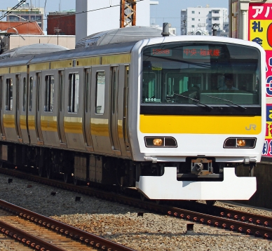
三沢線仲間国鉄285系のラストラン. 三沢線の橋本駅に285系カガH1編成(285-71f)を止まる. 橋本市菜花都仲間国 Mizawa Line 285 series last run. 285 Series set KaGaH1 (285-71f) stopped at Hashimoto Station. Hashimot City, Nanohana, Nakama -

2022 Holiday Traffic Report
Forsma7 commented on Forsma7's City Journal Entry in Karasem V 4.12 (AIN)
thanks its partially photoshopped to add the numbers of traffics and the barrier, other than that its made in game- 5 Comments
-
- 1
-

-
- mudik
- arus mudik
- (and 4 more)
-
So first of all, sorry that Bandan update was delayed to undecided time lol. Anyway..... This is the continuation of "annual update" I did from 2012-2019 which show holiday traffic on intercity roads around Karasem. This series wasnt continued in 2020-2021 because intercity travel was impossible due to the "human malware" situation. So yeah this is a revival of that series. 2022 Holiday Traffic Report Introduction: April 29 2022 is 3 days before Idul Fitri in Karasem, lot of people go to their hometown to celebrate ied with their family. It has been 2 years without this tradition due to the travel limitation imposed by the government but finally the limitation partially lifted with the pandemic died down in Karasem. These travelers come from the major metropolitan areas such as Meriah Metropolitan Area and Cibebek-Kota Baru Metropolitan area. Travelers went to various areas in Karasem such as Southern part of Cikulon Islands, Sumut Island, Great Natuna Islands and other places in Karasem. The tradition mostly take places on western part of Karasem as majority of population are located. Map of western Karasem This year peak of hometown bound traffic predicted to take place on Day-3 (29/4) to Day-2 (30/4) of eid. Based on the observation, the number of travelers keep increasing since this morning. Ministry of Transporation enacted several policies in order to avoid long traffic jam. These policies includes the contraflow on several expressway including Meriah-Malang Bawah expressway, Muara Karang-Krangan Expressway, Kota Baru-Bankalan Expressway and Cibebek-Cikaas Expressway. Other policy enacted include the odd-even rule of the car license number that can use the highway on selected time. However due to the network capacity limitation and the number of traveler is very high, traffic congestion hit main lines throughout the country. First report today is from area around Malang Bawah, Cikulon Utara Province. Malang Bawah-Purwasari Expressway ever since the completion on 2018 has been a major relieve on the bottleneck of route around Malang Bawah where the Meriah-Malang Bawah Expressway ends. Situation are mostly smooth despite on high traffic volume using this route to reach Purwasari and areas on Central and South Cikulon Province. Traffic on the Malang Bawah-Purwasari Expressway in km 45 of Malang Atas Regency As for the traffic going through regular non motorway main national roads monitored to be rather congested, most of these people are bound to areas in western part of Central Cikulon, mainly Sumberjati and Sukasirna areas while some other are going to South Cikulon as an alternative route of the expressway route through Purwasari Traffic in the Western Cikulon coast route of National Route 1 around Sukasari Border of North and Central Cikulon Province As for the traffic of the motorway connects Meriah and Malang Bawah, Meriah-Malang Bawah Expressway, congestion spotted on several location. Rest area alongside this motorway has been an issue of the traffic congestion due to the traveler trying to enter the already full parking on the rest area. one of the rest area with this issue is in KM 82 from Meriah on Malang Bawah Regency. Traffic queue on this rest area lined to 1 km and affecting all 3 lanes on this motorway. Some of the traveler even park on the side lane of motorway which can be dangerous. Officer advices traveller to limit the parking time up to 30 minutes to alleviate the queue and there has been several closure on the rest areas with full parking spaces alongside this route. Traffic queue to the Rest Area KM 82 Meriah-Malang Bawah Expressway. Next report is from the Meriah-Kota Baru Expressway. This motorway is the main route that connect 2 major metropolitan area of Karasem, Meriah and Cibebek-Kota Baru. Traffic are known to be congested from both direction due to the high volume. The Expressway operator PT Jalan Tol Karasem temporary disabled the Sumberrejo Toll Gate as the transaction now combined for both section of this expressway (Meriah-Kemayoran and Kemayoran-Kota Baru). The opening of Kota Baru-Meriah High Speed Rail which was constructed in cooperation with Teiko in April 23 alongside this route has helped alleviate the traffic demand on this very crowded route on this season as the ticket of trips from April 28 to May 4 has been fully booked as of today. The operational of the Kemayoran Integrated HSR Station-Bus Terminal also utilized by traveler that use this mode to travel to the eastern part of North Cikulon Province. For the conventional train route between these two city also has been fully booked up to May 5 for this holiday season. Meriah-Kota Baru Expressway on Krangan Regency also shows the newly opened High Speed Rail. Last we go to the Tanjung Pasir Regency. The recently opened part of Tanjung Pasir-Bandan Expressway first section has saved traveler times. The 29 km expressway connected the Tanjung Pasir Selatan to Semilalang in Tanjung Pasir used by those who are going from Cibebek to the eastern part of Natuna Island. As for the situation on Semilalang exit, there is minor congestion reported for 500m when it join the Karasem National Route 1. Semilalang exit of Tanjung Pasir-Semilalang Expressway Thats all for today! Happy Eid Al Fitri for those who celebrate it! And wish you all reading this all the best.
- 5 Comments
-
- 28
-

-
-
- mudik
- arus mudik
- (and 4 more)
-
survey Network Addon Mod & SimCity 4 - Hardware and Software Survey
Forsma7 replied to Ulisse Wolf's topic in NAM & Transit Networks
I would drop this here since I think I had a rare configuration here where I had LHD-Euro texture and have 2 different set of NAM installation, one is NAM 32 (old one ik) which used mostly for my older cities where T21 compatibility is real issue and NAM 43 for my newer cities that I made since 2019s.- 12 Replies
-
- 1
-
-
- simcity 4
- network addon mod
- (and 2 more)
-
(Trailer and Background) I • SUEMORI 末森
Forsma7 commented on RipRap's City Journal Entry in Okaiken V5
nicely done simple but teasing -
nice start... looking forward for the sengoku part!
-
Special 10th Anniversary and Sukamaju-Tanjung Angin Revisited
Forsma7 posted a City Journal entry in Karasem V 4.12 (AIN)
Today its basically 10 years after I posted my first entry on Karasem CJ. Since then its been a very long journey out. from the pure 100% eyecandy, then experimenting on makes it semi functional and improvement in its quality in general, out from multiple long inactivity and revival but I managed to stay on this theme together with my East Asian Theme in SimCity 4 until today. Infact some of the area on today's entry basically just made few hrs before I posted this. basically my first picture on this CJ about Tanjung Angin Port, taken from the post 10 years ago. Karasem was actually made by my concept on Imaginary region of Southeast Asia. From around 2005 I already created concept on imaginary region of Southeast Asia based heavily where I grew up which is Java Island, Indonesia but this concept never really come into truth other than my hand drawn map (which I lost now). I tried to put it into SC2k which what I played back in the day however its still limited due to sc2k limitation. Up to 2008, I got my hand on SimCity 4 where initially I just play it vanilla until I started to use mods later that year. in 2009, first concept of imaginary Southeast Asian region finally started to realized in SimCity 4 with me started to make East Rockcoast MD in SC4Devotion. At first the style not even close to southeast asia, but toward the end of it in April 2010 it started to shape itself into one. one of the remaining survived picture of East Rockcoast, showing westrn part of Kemayoran City. And then around mid 2010, I started to work on a fictional nation named Melaka Timur (en: East Malacca, which named after the Strait of Malacca) however due to some problem (due it being an offensive word in other language) I changed it into Karasem which I derived from Karang Asem (which was randomly came into my mind back then). then concept of Karasem basically founded in around August 2010. I started to create custom lots out of the maxis prop and some other mods (like japanese houses, colonial styled buildings, slums, favelas etc) and I honestly enjoyed it. Firstly I just make eye candy park/landmarks lot then I evolved to make myself growable lots and so on Old Picture from Karangutara, from 4th update dated November 13 2010. Probably one of the most iconic picture from Karasem, first time showcasing urban area in Developing Southeast Asian Country. represented by Pondok Daun, Cibebek Province. I didnt posted my updates in ST CJ for update 6 to 26. Finally in August 2012 I'm back posting my updates regularly in Simtropolis at 2nd Karasem CJ Started also from 2012 annually I posted "Holiday Traffic" entry timed with the Eid Holiday Season on that year to reflect the home coming traffic for people from major urban areas to their hometown. I posted it every year either as full entries or just a simple pictures except in 2020 due to lockdown First "Holiday Traffic" annual entry picture from August 2012. Latest "Holiday Traffic" annual entry picture from June 2019. In 2013 I started other SC4 project based on East Asian (mostly Japanese) country: Nakama (also Nakahara later on). and since then Karasem basically become my 2nd priority on work. Karasem get regular updates until January 2015 (Update 39) where I posted "Final Update" on Karasem thinking to actually stop doing my Southeast Asian style and focus entirely on East Asian one. Banner of Karasem "Final Update" on January 2015 However. I changed my mind 6 months later and started working on Cibebek Metropolitan Area where I focused more on the transit works and the proper concept of city. It took me 1 year before posting the first update (Update 40) announcing the return of Karasem (which is this CJ). Since then I posted several updates until 2018 where I started to focus more on Discord (including ST discord) and kinda left myself inactive on this site for that reason lol Picture from Tanah Baru, Cibebek as the returning entry of Karasem after its hiatus. Then 2 years later here we are. my last update on Karasem was about Tanjung Pasir revamp (update 48). I was going to post my update 49 which was about Holiday Traffic in 2020 however as I mentioned above, because of lockdown and I reflect that special update to what in real life it didnt happened. +-------------------------+ Anyway long story, time for the proper update I want to show. Similar like what happened to the latest update of Nakahara (Hagikaze) This update concepts basically made few weeks beforehand so I need to do it from scratch instead of continuing from my old stuffs. The general concept of the update is to present the first areas presented for Karasem which is Sukamaju and Tanjung Angin but in my latest style on Southeast Asian styled SC4. Reflected from 2010, I completely started over the area in blank new but still maintain the original idea of it. I would like to start from where it was started at the very beginning, Tanjung Angin Port: Pictures from Tanjung Angin Oil Facility. The general idea of Tanjung Angin now turned from general cargo port into mostly consist of Oil Facility, refinery and distribution center together with minor general cargo port facility nearby (not done by the making of this update). This time I tried to model it as realistic as possible (might still consindered to be fail but I digress) after several examples I took which are Balikpapan and Cilacap Oil Facility. Housing Areas east of the facility owned by the Facility Operator: PT Pertamax Oil TBK Tanjung Angin itself is a district in Sukamaju Regency, just south border of Sukamaju Town where the regency administrative center located. outside of the oil and other port facility it also consist of minor towns. Areas in east of the Oil Facility, still owned by locals, Tanjung Angin Overview of Tanjung Angin Oil Facility. Other than Tanjung Angin first entry also introduced Sukamaju Town (refer to the first update link) located just north of it. In this version of Sukamaju its now properly sized town for regency seat. kinda modeled after similar towns/small cities around Java with its features includes a station (if that town passed by a rail), Alun-Alun (town square/park), Market, and a mosque. Sukamaju City Center, includes Sukamaju Station, Alun-Alun Sukamaju, market and Masjid Raya Sukamaju Sukamaju itself located in northeastern part of Cibebek Province, about 90km Southeast its nearest major city, Pondok Daun and 130km Northeast of Cibebek-Kota Baru Metropolitan area. Sukamaju Regency has population of 306k, 82k of them resides at Sukamaju district town where the regency seat located. Jl Raya Sukamaju-Ciujung in Western Sukamaju heading to Ciujung to the west. Areas in northern Sukamaju district Sukamaju border in the east marked with Cikamulya River, flowing throughout the regency. Jl Raya Sukamaju-Karangutara crossing Cikamulya River (the smaller bridge was old one before the road enlarged) Cikamulya River in Northeastern Sukamaju. (click here for full size 5mb mosaic of Cikamulya River in Sukamaju) Jl Raya Sukamaju-Karang Utara northeast of Sukamaju Distance between Sukamaju town center and Tanjung Angin port is around 5km connected mainly by Jl Raya Tanjung Angin to the south. Jl Raya Tanjung Angin in southern Sukamaju Overview of Sukamaju center Sukamaju has 2 main access from the nearest Ciujung-Karang Utara Expressway: Sukamaju Timur exit which located east of the town and Tanjung Angin exit which located in south between it and Tanjung Angin Ciujung-Karang Utara Expressway near Sukamaju Sukamaju Timur ramp exit. Sukamaju Timur access to the Jl Raya Sukamaju-Karang Utara Overview of the area That its all for today, I really want to make something better and bigger for 10th anniversary like the flashback on each year but instead its already too late to change the idea. Lets hope if this CJ can stay for next 10 years whether it stays in SimCity 4 platform or moved it to Cities Skylines which I still personally prefer sc4 as my city building game. Thank you for visiting!- 5 Comments
-
- 31
-
-

-
So I was going to post full update but I have no energy to do it today, I hope I can do it soon All pictures are from Sungai Lesong, Bandan which where the next update will takes place
-
- 12
-
-
-
- karasem
- southeast asia
- (and 1 more)
-
Node V (Boss #2) Group C - 1.38x Group E - 1.35x Washington, South Dakota, Northampton, Atlanta , Fletcher - 1.32x
-
Its Neko's rice field which can be downloaded here http://hide-inoki.com/bbs/archives/sc4_0820.html
- 4 Comments
-
- 1
-
-
- karasem
- southeastasian
- (and 2 more)
-
Just some pictures from the region I've been working on, Bandan. Bandan is Karasem 5th largest city located in West Natuna Province with population of slightly above 1 million people. These two pictures are from Muara Betung, western part of Bandan. Train Scene from Tanjung Pasir-Bandan Railway nearby Sungai Lesong (Lesong River), just outside of Bandan.
- 4 Comments
-
- 12
-
-
-
- karasem
- southeastasian
- (and 2 more)
-
Simple picture from Ciujung-Karangutara Expressway near Sukamaju Timur Exit
-
Teaser: Onward 10th Anniversary of Karasem
Forsma7 posted a City Journal entry in Karasem V 4.12 (AIN)
So basically its close to 10 years from the date first time I posted first post on Karasem CJ . To sorta celebrate it I plan to revisit the area I made first time on this CJ, Sukamaju-Tanjung Angin area that already remake with the current standard of my SEA city in sc4. For now, I'll just post these pictures as a teaser (some might already posted in discord):-
- 9
-
-
-
- karasem
- southeastasian
- (and 1 more)
-
Nakahara 26: "Hagikaze no Shigure" (Hagikaze, Asasaki)
Forsma7 posted a City Journal entry in Nakama (AIN) and Nakahara
Well I'm back after 3 years.... or sorta So basically from 2 months ago I was working on this city, Hagikaze after a short discussion in discord server about SC4 map of Hagi city, Yamaguchi Prefecture, Japan. And then I'm thinking about doing something in SC4 new and I decide to use that map. The city name is Hagikaze which basically just modified from the original place name. I made the city itself kinda inspired by Sasebo, Nagasaki mixed with the original real life place as well (Hagi, Yamaguchi). On the other hand, right 6 years ago, I posted Update 5 of Nakahara and I decided to use the same date to post new update of Nakahara after hiatus for 3 years. Either way I'll jump into the update now. Hagikaze city (萩風市) is a city in western part of Asasaki Prefecture, Kyushu region, Nakahara. By 2019 it has population of 356,022 with the area of 453 Km square. It is the 2nd largest city of Asasaki Prefecture after the capital of Asasaki. Its a showering (時雨) day here since it is rainy season (梅雨) on Nakahara. Hagikaze Castle, the landmark of the city, built on 16th century. Shizuki-yama north of Hagikaze castle. Area of Furuwara, the old town of Hagikaze south of the castle Overview of Northwestern Hagikaze featuring Furuwara and Shizuki-yama. Hagikishi area. featuring bank of Noshiro River. Hagikaze was part of Amabe Province, Nakahara by the old province divisions of Nakahara. by 1863 it has population of 30,000. it grow as the traditional fishing village surrounding Hagikaze castle. In 1884 Nakahara government decided to build port in Hagikaze for its protected, deep-water harbor, and proximity to the mainland. In 1889 Hagikaze Naval Base opened in the northern part of city with the Naval Arsenal and Repair Facility which accelerate the growth of Hagikaze. Hagikaze city as municipality itself formed later in 1904. Hagikaze port in northern part of city. it's located just south of the Naval Base and Shipyard. Yuihama area of Hagikaze traditionally part of the old Hagikaze fishing village. Western part of Yuihama Hagikaze cruise and ferry terminal serving travel between islands in northern part of Asasaki Prefectures and surrounding Hagikaze Station of NR Hagikaze Line and Matsukawa Line, located in the western-central of city. Nagao-cho area of Central Hagikaze (west of Hagikaze Station) Shimokyomachi, Central Hagikaze Area of Kitanishizumi-cho, Central Hagikaze bordering Furuwara to the north Area of Shiraki-cho Kamoi Station of NR Noshiro Line, southern central Hagikaze Kamoi-kita area of Southern central Hagikaze Nishi-Kyushu Expressway connect Hagikaze and rest of Kyushu and Matsukawa in western Asasaki Prefecture passed the central Hagikaze from east to west. Hagikaze-chuo IC exit of Nishi-Kyushu Expressway just north of Hagikaze Station Nishi-Kyushu Expressway crossing Noshiro river featuring area around Kasuga Station of Matsukawa Line. Noshiro River (能代川) is a major river flowing in the western to the south of Hagikaze. it is one of the main river of Asasaki Prefecture. Noshiro River in southwest Hagikaze Kosato-bashi (Kosato bridge) of Noshiro River. Maikawa-bashi (Maikawa bridge) of Nakahara National Route 205 crossing Noshiro River. Fujimi in southwestern Hagikaze Hagikaze surrounded by mountainous area of Asasaki Prefecture. one of the mountain of city is Arashiyama (嵐山) located in southwest part of city where part of city sprawl can be seen. Arashiyama hillside including area of Arashiyama-cho and Maikawa-cho in southwestern Hagikaze Arashiyama-cho Maikawa-cho Nakahara National Route 205 in Maikawa-cho Overview of Western Hagikaze +---------------------------------+ Allright thats all for this update mostly only western part of city since this is the only part I've done so far, hope you enjoy it. Future update might include the eastern and northern part of city or I might just back to Akashima or Shinkyo, just depends on my mood anyway... Thanks for viewing! and happy 2nd Anniversary.- 12 Comments
-
- 39
-
-
Nakahara 26: "Hagikaze no Shigure" (Hagikaze, Asasaki)
Forsma7 commented on Forsma7's City Journal Entry in Nakama (AIN) and Nakahara
it's uki-sim's seawall4 http://uki-sim.seesaa.net/article/245190662.html -
Nakahara 24.3: "Nightfall ~ Evening Stars" (Amakusa-cho, Akashima)
Forsma7 posted a City Journal entry in Nakama (AIN) and Nakahara
2nd part of the Update 24... now its about Amakusa-cho, Akashima which located in south of Imaizumi-cho. +-------------------------------+ Nakahara 24.3: "Nightfall ~ Evening Stars" (Amakusa-cho, Akashima) Another day in Amakusa-cho (天草町), area in Nishi ward, Akashima. Its a rather windy day today as it almost entering fall season. Shot in northern part of Amakusa-cho Area in central of Amakusa-cho For people who want to find a rather easy access apartment and close to city center, Amakusa-cho might be one of a good choice as it located inside the loop line (Kogame Line) of Akashima. Higashi-Amakusa Intersection in eastern Amakusa-cho Although it might not be a good idea if you dont want a quiet neighborhood. This area almost lively 24/7, partially because the presence of Akashima Expressway Chuo Line in the south of this area. Akashima Expressway Chuo Line in Amakusa-cho Nevertheless, there are a lot of available housing this area, as there are a lot of large apartment here, Central Amakusa-cho with dense residential area Not forget to mention, this area close toward mass transit, where Imaizumi Station of Kogame Line located in the north of this area. Northeastern Amakusa-cho bordering with Yatsuzawa-cho in east and Imaizumi-cho in north Or else, Yatsuzawa-cho which located in east of Amakusa-cho is another good choice to live in inner city Kogame Line in Yatsuzawa-cho more shot of Kogame Line in Yatsuzawa-cho Akashima Expressway Chuo-Line in Yatsuzawa-cho Overview of Amakusa-cho, Imaizumi-cho, Yukimori-cho and western Yatsuzawa-cho Over the night, this area, especially near the Akashima Expressway is pretty much lively. Nightshot from Akashima Expressway in Amakusa-cho Nightshot from Akashima Expressway in Amakusa-cho Nightshot from Yatsuzawa-cho More should be soon... Thanks for viewing!- 8 Comments
-
- 15
-
-
- east asian
- japanese
- (and 5 more)
-
Old update reposted from SC4D.. but whatever.... Note that this update take place at Winter 2017 as it when this update was originally posted at (thats why I set the time to that date) Update 19: Necrofantasia Winter time, the weather is cold though there is no snow currently in this city, Arakawa. Arakawa like its neighboring main city Akashima has rather colder winter than most of other major cities in Nakahara. People just business as usual in Shibahama area, Hokuto Ward, Arakawa City, Minamizaki Prefecture, Nakahara. Shibahama Station ekimae (area nearby Station) Its been 2 and half year after the major disaster hit this city back on the end of July 2014. Shibahama wasn't affected much by the disaster but its population activities did. The Metropolitan area of Akashma has completely recovered from the disaster as it looks like. Nishishibahama-cho, west of Shibahama Station Sanju-cho, East of Shibahama Station Morning and evening, commuters waiting at Shibahama Station east gate for the bus or just arrived by bus waiting for the train. Shibahama Station east gate Current temperature is 1 degree Celsius, rather warmer than last night where it reached minus 2 degree. People prefer to stay indoor at this weather. Commercial area in the east of Shibahama Station Western side of Shibahama Station Kitashibahama-cho, in the north of Nishishibahama-cho Some just ignore the weather and doing their activities outdoor like these people in the park. A park in the Nishishibahama-cho Thanks for reading....
-
Nakahara 26: "Hagikaze no Shigure" (Hagikaze, Asasaki)
Forsma7 commented on Forsma7's City Journal Entry in Nakama (AIN) and Nakahara
yes it is -
Nakahara 26: "Hagikaze no Shigure" (Hagikaze, Asasaki)
Forsma7 commented on Forsma7's City Journal Entry in Nakama (AIN) and Nakahara
its Japanese street side mod http://hide-inoki.com/bbs/phpbb2/viewtopic.php?t=856 -
Update 5: ヘビー�� ーテーション | Heavy Rotation 1 (Arakashi, Shinkyo)
Forsma7 posted a City Journal entry in 名神 | Nakami (SC4) closed
Replies ( 返事 ) @ jmsepe さん: Thanks a lot for being a loyal viewer @ カール さん: Thanks... I'll give you a KSI48 album Okaiken special edition then btw thanks for your comment about being to grid earlier which making the last update famous. @ tankmank さん: Thanks a lot! well not that much actually... @ NMUSpidey さん: Thanks a lot well I was ispired a lot by rural Chiba scene when making that area though.... for the name yes it does a lady name because I took it from a female name generator XD @ MilitantRadical さん: Thanks a lot! @ TekindusT さん: Thanks a lot! @ AdoxxBE さん: Thanks but its 80% fuctional actually (residential and commercial are growable though the ricefield do eye candy stuff) @ BlueSharkTheOne さん: Thanks a lot! @ paulmc さん: Thanks a lot! @ urielgarcia さん: Thanks a lot! @ NielsC007 さん: Thanks a lot! @ T Wrecks さん: Thanks a lot for commenting here! @ Drack さん: Thanks a lot! @ Schriefer さん: Thanks a lot! @ Richie99 さん: Thanks a lot! @ sejr99999 さん: Thanks a lot! @ gigius76 さん: Thanks a lot! @ vinlabsc3k さん: Thanks a lot! @ 89James89 さん: Thanks for the comment! Well last update was very success In my opinion thanks for you all viewers... this update very bad compared to the last though... +------------------------------------------------------------------------+ side note: I made many changes to my east asian nation so there would be many name changing mentioned here.. Update 5: ヘビーローテーション | Heavy Rotation 1 (Arakashi, Shinkyo) Well where was I on last update? oh yeah its from rural area in Watanabe Prefecture (formerly I called Aichi Prefecture) right? lets go back to the capital city of Nakahara (Nakama) which is Shinkyo (新京) (formerly I called Nanohana). In update 3, I showed some of Arakashi ward (新樫区) (formerly I called Soshi). this update also comes from there... before that let me played some song (well its 18 June which is "something" for me... ) http://www.youtube.com/watch?v=pKQlKygAMrg Yeah its part of commercial district on Arakashi where we can found w2w offices or stores buildings. same area but in different angle "wait is it the rush hour time? dang the traffic really nuts here... lets just listen to radio then ooh KSI48's Heavy Rotation is played at this moment! seems that the request come from some Okaiken guy.... " thats is... just 3 pictures for this update (*boo sound effect) . oh btw I wanted to showed you a picture from Suzuya ward (鈴谷区) (formerly Katorea Ward) in night time... -
Update 40: Limited Love (Tanah Baru, Cibebek Utara)
Forsma7 posted a City Journal entry in Karasem V 4.12 (AIN)
Well here we go again... I decided to bring this theme back into City Journal realm back earlier this year. Actually I've done several updates (40-46b) since this February in SimCity 4 Devotion but well, I might repost it here so everyone can actually see what I work. This first entry is actually a complete repost of Update 40 Karasem: Limited Love (17/02/08) +----------------------------------+ Update 40: Limited Love Cibebek Utara, Cibebek, Karasem. A district in Karasem's 2nd largest city where don't want to live but have to be.... atleast that for several people live in this area inside the northern part of Cibebek. People can shop a cheap stuff into high-end stuff in the Plaza Tanah Baru, a shopping centre built in 2003 alongside with the surrounding commercial area. A commercial center next to Simpang Tanah Baru (Tanah Baru Intersection) where Jl Saika Raya (north-south) meets Jl Raya Krajan (west-east) This commercial area, where you can enjoy walking alongside the road while shopping or just enjoy the atmosphere is really feels like you are not in Northern part of Cibebek. Commercial area in the east of Plaza Tanah Baru Alongside with Jl Raya Krajan, the commercial area is rather elite even compared to those in the main road. Jl Raya Krajan near the Ruko Plaza Tanah Baru In the night this area is bright, either from the evening traffic near intersection which sometime a worst situation or maybe from the lightning system inside the shoping centre Simpang Tanah Baru at night This area actually not very far from a mass transit station aside from local buses or paratransits. Tanah Baru Station located below the overpass of Jl Saika Raya which one of the main option for the commuter in Cibebek Metropolitan Area. Its located in the Jl Saika Raya which is Cibebek's main corridor toward the downtown areas where located in the south of Tanah Baru. Tanah Baru Station featuring Cibebek's Cibebek Railway 4000 series train. Nightshot of Tanah Baru Station Yeah this area actually close toward city centre and have easy access, why it so miserable? lets go to the north of the Intersection to see whats happening.... A hypermarket in Jl Saika Raya Tanah Baru . Alongside Jl Saika Raya it still rather nice with the exception of the daily morning and evening commute time where it's a real bumper to bumper. Jl Saika Raya crossing the Krajan River People can see something different from the bright side of the city by visiting the Krajan River which located in the middle of Tanah Baru Subdistrict... Not only at the Krajan River, much of the Cibebek Utara district of the city actually consist of slums and semipermanent settlements which prone towards fires and other risks. Behind the hypermarket in Tanah Baru.. Going deeper from the main street shows the other side of this area.... People come here anywhere from Cibebek Province or other places in Karasem somewhere in Tanah Baru Utara Subdistrict. east or west from Jl Saika Raya, there are slums... A slum area in Tanah Baru Timur Subdistrict. But, people in the riverside have much worse situation than any other area in Cibebek Utara District.... Not only live in the bad situation, they also in border of life when they got into the river whether incidentally or intentional since the river had a rather strong flow eventhough it has too many stuff in it, like plastic bag and used beds (no joke, somepeople really throw away their used beds into river). Riverside slum at Tanah Baru Utara Subdistrict Like in Jl Saika Raya, Jl Raya Pasar Krajan looks well and lively compared what behind it.... Tanah Baru Timur Subdistrict is one of area in Cibebek prone to flooding. Back in 2014, the flood breaks into this area, it even hit the Jl Raya Krajan in the south of it, disturbing the citizens activities. Riverside slum at Tanah Baru Timur Subdistrict Jl Tanah Baru Timur Dalam, an access road toward the residential area in North Cibebek crosses Krajan River. The slum extend until the border of Sawahan and Tanah Baru Timur Subdistrict in the National Route 2 Eastern part of Tanah Baru Timur Subdistrict featuring Karasem National Route 2 which connect Cibebek city centre with Keshan in Northern Karasem. As in the night, this area of city is very different with Plaza Tanah Baru where it's bright... Tanah Baru Timur riverside slum at night In order to reduce the risk of flood, the city government planned to do a revitalization alongside Krajan river which involve to reduce the river sedimentation as well to create the wall alongside the river. This already done in the Krajan River downstream as seen in Krajan Utara Subdistrict where the river in better situation. Krajan Riverside in Krajan Utara Subdistrict. Cibebek Expressway, the city main highway crossing the Krajan River in Krajan Utara Subdistrict. Although the area around the river still rather poor looking, this area which flooding in 2014, no longer flooding during 2016 flood which hit the Tanah Baru area due to the river revitalization work done in 2015 which done with several violence... Jl Kampung Dalam, where the previous work of revitalization meet the old looking riverside.... The city government planned to revitalize the river futher upstream, but this involve the displacement and eviction of the riverside settlement which mostly illegal. People alongside the river in Tanah Baru currently in the worrisome. They have a time bomb ticking where the have to move out from where they live now. Back in Tanah Baru Utara.... They don't know where to live after this, where they have daily activities. Other place just too expensive for them to afford..... To handle the displacement, city government currently building several housing project for people that affected by the project or other people around Cibebek Utara slums... First and second highrise building of the housing project currently being built in Jl Tanah Baru Timur Dalam. This area covered by the local bus with route from Tanah Baru Station toward Semawu in Northern part of Cibebek. Rusun Tanah Baru 1 & 2 (Tanah Baru Housing Project 1 and 2) alongside the Tanah Baru Timur Dalam. Other tower built literally right next toward Tanah Baru Plaza's commercial area which was a donation from the Plaza's developer Rusun Tanah Baru 3 (Tanah Baru Housing Project 3) built in Jl Raya Krajan in the south of the river. Some of the people think the housing project just too far away form they current location where it will be more difficult for people to reach where they have their activities beforehand... Tanah Baru Plaza with the housing project tower under construction. However, it is still very controversial whether it is a right thing to displace people in force as it might a violation toward the human rights. The citizens around the city still arguing about this.... Tanah Baru Timur Subdistrict. Whichever the right decision, people of Cibebek just hope this area will no longer become the city eyesore without humiliating some people.. Thats all for today. hope you enjoy this rather depressing update.. and oh maybe something not depressing? Saika Utara CBD alongside the Jl Saika Raya. Before going further, I might ask all of the viewer here, should I repost every single of my Southeast Asian City from SC4 Devotion here, it might took a while but I will catch up with update 47 which will come soon. if no, then I might just jump toward Update 47 as the next update of this CJ. oh here's the link to my entries in SC4D: https://www.sc4devotion.com/forums/index.php?topic=12773.440 +---------------------------------------------------------+ Replies: Bringing replies to the comment of Nakama Update 6: Memories of Snow: Well thanks a lot! trainspotting is interesting after all to search and took picture of your favorite train series... (atleast as what I think) Thanks ! a lot of these BAT's come from this site: http://hide-inoki.com/bbs/phpbb2/viewforum.php?f=7&sid=6241eb1e8c3ced79919101314d0ca976 also I used stuffs from various Japanese sites which unfortunately many of them down now.. obrigado . unfortuantelly I'm not speaking Portuguese. Thank you ! as for the stations, I link to them in the bottom of this post. Thank you! well, I give the link in bottom of this post. Thank you! great to see you here as well! Thank you! Thank you! its a lot of work to give a real feel of Japanese city... as for the stations, I give the link later in this post. Thank you! I like to do railway in SimCity 4 especially in Japanese city theme. Thank you! well most of these stations still available to download, I'll give the link below. Thank you! its a real hard work to do it but I really enjoyed to do that update! as for the station, its below.... As for those who asked the link toward stations from my last Nakama update here's the link please note that some of the station in the update actually reloted : Hashimoto Station (first station): http://hide-inoki.com/bbs/phpbb2/viewtopic.php?t=577 Mizue Station (second station): http://hide-inoki.com/bbs/phpbb2/viewtopic.php?t=604 Kozue Station (third station): http://www.bripizza.net/sc4/285sta/285sta_c.html#-2-2-x Shin-Mizawa Station for local line (forth station): http://blog.livedoor.jp/moonlinght/archives/cat_59226.html (search for the station) Shin-Mizawa Station for HSR line: sorry I think the web already down Kurihama Station (Mizawa Line): http://blog.livedoor.jp/moonlinght/archives/cat_59226.html (search for the el rail station link) Kurihama Station (Nazawa Line): http://hide-inoki.com/bbs/phpbb2/viewtopic.php?t=537 Iguchi Station: http://www.bripizza.net/sc4/1103tokestation/1103tokestation.html#b Mizawa Station: http://hide-inoki.com/bbs/phpbb2/viewtopic.php?t=434 Again thanks for the replies in Nakama update!- 10 Comments
-
- 14
-
-
- cibebek
- southeast asia
- (and 5 more)
-
@Tonraq: thanks for stopping by. might be the right time to restart the CJ works again. +----------------------------+ So to start this, let me put it this way. back in 2011-2012 I played SimCity 4 and created one city: Tanjung Pasir. this city meant to represent one part of Karasem which located next to a major straight crossing (recently has bridge opened). The area itself is a rather sandy peninsula in the northwest end of Natuna Island (as shown in map). It's main economy is from oil and gas refinery nearby the city and a major port (plus what used to be ferry crossing). I put the city and surrounding area population around 70-120k. Anyway tangent... basically few months ago I reopened the old cities of Karasem (for the holiday traffic update) and stumbled upon this one. I just feel eh... this is kinda uh (I know it just me blaming my old self) compared to my current standard and realism for the setting. I make several work to the city (show some in discord already) and I'll show some work. I might make full update about the area later on but for now its just about the work to revamp the city. Old Tanjung Pasir Station I feel like there are a lot of stuff off here, like for example the city itself isnt that big for this train station, then the track should end in terminus instead of loop like that (plus its no smooth curve) the old city (town) center only consist of this small market with the round road around it The Tanjung Pasir Expressway nearby, uhh that exit . and note that railway is double track in the old version and some random freight terminal This is the overview of the old Tanjung Pasir and yeah thats the only part of city with the road heading outside the city Ok enough for digging old stuffs, now time to review the new works. The new Tanjung Pasir Station, I made it straight into a terminus instead of the older work of it with loop and turns. I also make the station located nearby the Pasar Tanjung Pasir (Market) where it make more sense now. I also add the workshop or some sort of locomotive depot next to the station. This area used to be the old station area, now I turned it into the city utilities office and school. I also add Alun Alun Tanjung Pasir (central square) in the area used to be old station. I also expand the old southbound road from the city into 4 lanes because this is main road from Tanjung Pasir to Bandan, the largest city and capital of Natuna Barat Province. I didnt do much to this area aside from populate the city and remove the station but anyway just want to show how the area which used to be city center now (which no longer become center). And now the Tanjung Pasir Expressway, note how I remade the intersection and turned the rail line into STR (and remove that random freight station since the industrial area is in north) And I guess thats all for now. feel free to comment my works here.. suggestions are welcome.
-
i dont know basically, I just feel I really need to continue this annual update I've done since 2011.. So anyway basically I didnt do much SC4 for past 6 months and for last 2 days I made some stuffs just for this tradition in my CJ. Either way enjoy this minimalistic update . Update 45d: 2019 Holiday Traffic Report Introduction: As it's 1 days before Idul Fitri in Karasem, many people go to their hometown to celebrate ied with their big families. most of the travelers come from major cities like Meriah, Cibebek and Kota Baru toward hometown. as for 2019 data from both Cibebek Metropolitan Area and Meriah Metropolitan Area, about 32% of travelers go to Central Cikulon Province (Capital Purwasari), 27% to South Cikulon Province (Capital: Tanjung Bambu), 20% go to Kasemetapang Province and other places in Northern Islands 18% toward various places in North Cikulon Province (Capital: Meriah) and the rest go to other provinces. The tradition also occurs in other places in Karasem but mostly in Western Karasem which is much more populated than eastern part. Map of western Karasem Based on the prediction and survey this year, there is no significant peak for hometown bound traffic since the holiday started since last week however the highest count happened in day-2 yesterday. Today is Day-1, the traffic has decreased however several traffic alteration still applied in several location. First report from the area around Malang Bawah, Cikulon Atas Province. Last year this area traffic has been improved compared to 2 years ago after the completion of Malang Bawah-Purwasari Expressway. This year traffic seems to be improved much better with several policies including the contraflow of Meriah-Malang Bawah Expressway and the one way system around Kedawung exit (current terminus of the Meriah-Malang Bawah Expressway). Ministry of Transportation alongside with PT Jalan Tol Karasem enable the contraflow on this expressway from the Km 0 at Meriah to the Malang Bawah JCT where the highway split with Malang Bawah-Purwasari Expressway. Contraflow on Meriah-Malang Bawah Expressway As for the traffic in the Malang Bawah-Purwasari Expressway there isnt any significant jam happened since the start of the holiday season. However there is significant increase of traffic compared to last year due to the full operational of this expressway Traffic on the Malang Bawah-Purwasari Expressway in km 73 in Malang Atas Regency Next is the report from the newly opened Muara Karang-Krangan Expressway which is parallel to the Meriah-Kota Baru Expressway. There is also contraflow traffic applied here bound for Kota Baru Cibebek (eastbound). Same alteration also applied in Meriah-Kota Baru Expressway where the contraflow applied for the westbound traffic until both highway merged at Krangan. The traffic in Meriah-Kota Baru Expressway in general is pretty fine except near Sumberrejo Toll Gate where the traffic queue for about 4km in both direction to pay there. Contraflow Traffic in Muara Karang-Krangan Expressway Next is the report from the Cibebek-Tanjung Pojok Expressway. The weather seems to be rainy here. Cikopo area previously known as the traffic jam area on every year holiday season for the travelers heading toward Tanjung Pojok port to cross to Ketapang Province. With the completion of Cikopo-Tanjung Pojok section of Cibebek-Tanjung Pojok Expressway in April 2015, the traffic not a major problem in this area except for the toll gate pay in this area. Traffic in Cibebek-Tanjung Pojok Expressway km 37 Last we go to the Tanjung Pasir area. This area is the connection from the Cibebek Province to the Natuna Islands via Tanjung Pasir-Bankalan Bridge where most of the travelers from the major urban areas (Meriah and Cibebek) or anywehere in west Karasem travel to the eastern part of the country. A 3km Queue happened in the Tanjung Pasir Selatan Exit which is the current terminus of the highway, By the next annual holiday season traffic expected to be least concern in this area with the completion of Tanjung Pasir-Bandan Expressway first section which should divert the traffic to the east part of Natuna from the current exit. Queue in Tanjung Pasir Selatan Exit, Tanjung Pasir Thats all for today hope you all enjoy it! And Happy Eid Al Fitri for those who celebrate it!
- 1 Comment
-
- 10
-
-
-
- mudik
- arus mudik
- (and 4 more)
-
I think I've said something about gentrification and the city before. It might be controversial at first place but I find that gentrification itself can be beneficial to the city, one of the example being giving the city itself its own culture and atmosphere. Remember that I saw one old single home between modern contemporary buildings and apartments that simply because people decide to stay at the gentrified area which is really interesting
