Supported

About This File
Hello simtropolians. This is my second upload to ST, and is the version number two of the first map of Valles Marineris, with a better resolution and more accurate to the reality. As everbody knows, Valles Marineris is a system of faults and canyons located near the equator of Mars, at the east of Tharsis. Unlike its predecesor, this map is more accurate to the reality. It was made from a grayscale map extracted from a site of the USGS, Map-a-planet, with a topographic map made by MOLA, Mars Orbiter Laser Altimeter.
About the region.
It has 160 cities, 55 big cities, 32 medium cities and 73 small cities. The zip files contains two folders:
Valles_Marineris_V2 (root):
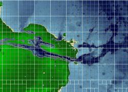
Valles Marineris Aereal: a look from the SC4Terraformer, this will give you an idea of the cities distribution and the sea level.
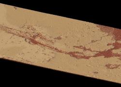
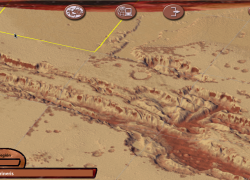
Valles Marineris Mars Terrain: this is an look of the region from the standard of SC4, with the Terraformer 1000 Mod in Sand Desert Terrain.
Readme: the readme file, is the same description as here.
>Grayscale folder:
config.bmp: the standard region config.
vallesmarineris.png: the grayscale map.
>Terraformer folder:
config.bmp: the standard region config.
vallesmarineris.SC4M: the map for the SC4Terraformer.
about.html: a single html file for SC4Terraformer.
Installing the region
There are two ways to install the region, using SimCity4 or SC4Terraformer:
Classic way, using SimCity4: Create a folder in Regions with the name Valles Marineris, or another name. Copy the config.bmp and the grayscale map, vallesmarineris.png, located in the folder Grayscale. Then run SC4, open the region and then load the grayscale with ctrl+alt+shift+r. This is the suitable way if you want it for SimMars.
Using SC4Terraformer: create a folder in Regions with the name Valles Marineris, or another name. Copy the config.bmp, vallesmarineris.SC4M and about.html. Then run SC4Terraformer and load the region folder, go to Global Tools and select Import image, select the file vallesmarineris.SC4M in the folder region and load it. Modify it as you want and save it.
Notes
The sea level is too high, this will not look well in a terraformed enviroment (using an Earth terrain) and the region will be more water than land. Since there are no seas on Mars, the default level is a datum based in the triple point of the water, at 610,5 Pa of presion and 273.16 K, this is probably the level 0 of the map. With SC4 Terraformer is possible to raise the terrain and give to the region a more balanced look, just go to Global Tools > Raise Terran and write a value, reccomended between 100 and 170. A value lower than 100 will show more water, a value over 170 will show more land.
Also, for Linux users using SC4 with Wine on Gnome Shell or Cinnamon is recomended to disable screencast of the desktop, that is activated with the combination ctrl+alt+shift+r and interferes with the game, that doesn't allow to load the grayscale map. You can disable screencast with the keyboard settings under System Settings > Keyboard > Shortcuts.
Enjoy!