Supported


About This File
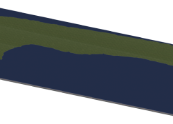
This is map #3. It shows the island Langeoog whichis one of the seven inhabited East Frisian Islands at the edge of the Lower Saxon Wadden Sea in the southern North Sea, between Baltrum and Spiekeroog.
This map contains 10 x 4 large cities (40x16).