

 Supported

About This File
NHP Burns Oregon By blade2k5
Map Details and Information
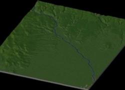
Burns is a city in and the county seat of Harney County, Oregon, United States. The population was 3,064 at the 2000 census, with an estimated population of 3,020 in 2007.
Burns was established in the early 1880s and incorporated upon Harney county's creation in 1889. It was named for the Scottish poet Robert Burns by early settler and County Commissioner George McGowan.
According to the United States Census Bureau, the city has a total area of 3.6 square miles (9.2 km²), all of it land. It is 136 miles (219 km) east of Bend, Oregon, and 130 miles (209 km) west of Ontario, Oregon, on U.S. Route 20 at its intersection with U.S. Route 395, 186 miles (299 km) south of Pendleton, Oregon. A third highway, Oregon Route 78, runs 92 miles (148 km) from Burns southeast past the Malheur National Wildlife Refuge and Steens Mountain to Burns Junction, Oregon.
Map Specifics
Map Type: Real World
Region map size: Map is configured for 20 large city tiles and is 4x5 in size.
config.bmp size: included with zip file
Dependencies: Either SC4 Mapper or SC4 Terraformer for importing.
Maps were created by taking 1/3 Arc USGS DEM elevation data.
Install/Uninstall Instructions: Can be found in the readme provided.
Credits
blade2k5 - Original map creation, scaling, importing. SC4TF modification.
Check out more maps by blade2k5 and NHP
Any comments and feedback welcomed. Thanks for looking and enjoy.

