

One Last Drive Through Harbor Country

Hello Everyone!
It's been far, far too long. I hope life is treating each of you very well!
I'm happy to present this entry, but it feels a little bittersweet. Today we will take one last drive through the Little Traverse Bay harbor country. This city has been nearly three years in the making! I never anticipated that it would take this long, but real life always seems to pop up. That being said, I feel like this is the most complete city I have ever made. I'm pretty happy with the direction that the build has taken over the years. On to some photos!
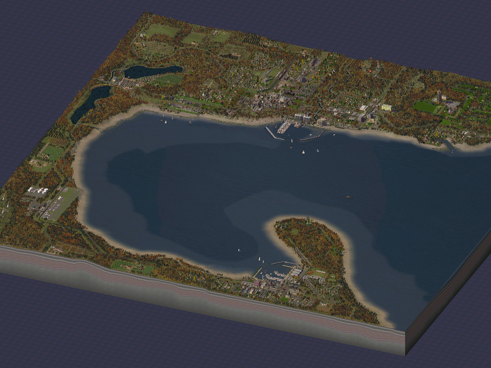
US 31 winds its way around Little Traverse Bay, and we find ourselves starting at the southern most end of the city. This is where we find the vacation getaway that is Bay Harbor.
The village boasts a gas station, county sheriff's office, volunteer fire station, and a few small shops. Bay Shore's population jumps up in the summer as vacationers arrive at their cottages. The premium attraction is the Grand Traverse Resort & Conference Center. There is a large golf course that is quite popular!

Here is a closer look at the cottages that cover the bluffs.

Further east along US 31 we arrive in Petoskey. The city has seen some changes, the biggest change being the water front. A better tour is available in the previous city Journal that highlights the town.

This is the updated water front. The dock space organization is much better. I also wanted to highlight the water front's industrial heritage. Gentrification has swept through the heavy industries. Many of the working class homes have also been converted into more modern living spaces.

The downtown area is still a bright spot in the region!

East of Petoskey are the hills that surround Walloon Lake. The countryside is filled with wineries, dairy farms, and many staple crops. Bay shore, not to be confused with Bay Harbor, is visible at the bottom of the photo.

This is the heart of Walloon Lake. The village is home to the regions agriculture. The railway station is over a hundred years old! The large rail trestle is a popular spot for photographers. A man made channel connects the two portions of the spring fed lake. This area is popular with kayak and boating enthusiasts, as well as fishermen.

Farms, a church, a winery, and a few small homes dot the countryside south of Walloon Lake.

Back on US 31, the highway winds northward along the coast line. We see the forests, dunes, hills, and the North Branch of Walloon Lake that make up Petosaga State Park.

Whoa, watch the road...

More farms, more coast line.

We've arrived at Menonaqua, just outside of Harbor Springs. The main point of interest here is the Traverse Bay Regional Airport. Menonaqua also hosts the region's fuel depot, wind farms, recycling waste center, and a train station. Three highways connect in this small town. We'll continue west on US 31 from here. Fortunately there is good signage to point travelers in the right direction.

Hey, check out this wind farms. Logging is still taking place here as well.

We've nearly reached Harbor Springs. This farm stands overlooking the Pere Marquette Railway line as it approaches the town.

We've arrived in downtown Harbor Springs. This small town is a famous vacation destination in the north country. The town has a strong tourist and industrial past. It is situated on the northwest corner of Little Traverse Bay, making a nearly perfect natural harbor.

And here's that harbor. This photo is looking northward.

The Iron Horse Hotel is still in operation both as a hotel and a train station. There are many tourist activities available along the boardwalk area. People are clearly enjoying the day.

The western edge of downtown is the industrial area. Manufacturing in the area has changed over the years, but Northern Lumber and Acme Boiler continue to be profitable. Harbor Mill Works closed two decades ago, but it has been revitalized as a centerpiece for the downtown. It now houses shops, restaurants, and apartments.

US 31 winds north at Harbor Springs, but this photo is taken looking towards the south, back towards the Bay. The land formation is Stafford's Point, an homage to the family that settled here in the early 1800's. The point is now home to multi-millionaires. At the bottom of the photo is Harbor Springs School and the Point West neighborhood. The Harbor Springs Union Hall and the industrial area can also be seen.

Well, we've come to the final photo, and it pretty much sums up life in this corner of the word. We see people of all backgrounds lining the pier. Some are fishing, some are boat watching, others swim or just enjoy the day. A sharp looking speed boat is returning from a cruise on the bay...

That's all from Harbor Country! Thank you all for reading over the past few years! It has been a lot of fun making this project and sharing it with all of you! I hope life continues to treat each of you very well.
-
 26
26

14 Comments
Recommended Comments
Sign In or register to comment...
To comment in reply, you must be a community member
Sign In
Already have an account? Sign in here.
Sign In NowCreate an Account
Sign up to join our friendly community. It's easy!
Register a New Account