Supported




About This File
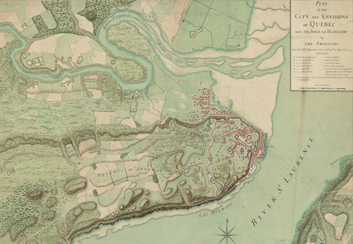
After a few false starts, I've finally gotten this map of Quebec City and its environs together enough to post. This map is relatively close to 1:1 vertically and is exactly 1:1 in height and width. I used a 1776 map of the city to draw the waterways in as they originally existed before being developed, including adding a shelf just under the water level to approximate marsh and shallows. The waterways and lakes are a compromise between reality and what SC4 can reproduce. You can keep them as they are, or use the smooth tool in God Mode or Terraformer to turn them into waterways to use ploppable water in instead if you wish.
This download is a .zip file that includes a SC4M file, a few randomly generated config.bmp files, a 16-bit PNG heightmap to import into SC4Mapper if you'd rather use one of the config.bmp files, and four maps: a topo map, a clipped OpenStreetMap aligned with the region to show how the city grid maps onto the existing city, and two historical maps: one from 1776 and one from 1894. These are interesting because they show how the waterfront has been built up over time.
Enjoy!
-
 6
6
-
 2
2