Supported

About This File
Good evening all.
2nd Indonesia Map and 5th Map in overall from me.
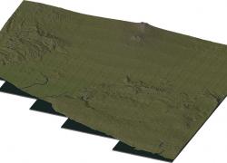
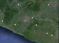
This is the map from Yogyakarta Special Region, a province on southern coast of Java, Indonesia. It features city of Yogyakarta with 4 neighboring regency also few regencies in Central Java Province in its corner. Geographical features includes Mount Merapi and Merbabu in north part of region, Indian Ocean in south coast and several hilly area in it's area.
This region has size 44x48 km square (9x6 large city tiles) about 80% of its original. created using data from ASTER GDEM and edited using photoshop and rendered by SC4mapper.
Read the readme for installation instruction.
Enjoy!