

 Supported

About This File
Porto Alegre is the eleventh most populous municipality in Brazil and the centre of Brazil's fourth largest metropolitan area. It is also the capital city of the southernmost Brazilian state of Rio Grande do Sul.
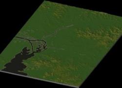
The city lies on the eastern bank of the Rio Guaiba (Guaiba Lake), where five rivers converge to form the Lagoa dos Patos (Lagoon of the Ducks), a giant freshwater lagoon navigable by even the largest of ships. This five-river junction has become an important alluvial port as well as a chief industrial and commercial center of Brazil.
The port of Porto Alegre is important for transporting local produce. The "Gaucho capital" has a broad-based economy that lays particular emphasis on agriculture and industry.
Porto Alegre has a long coastline on the Guaíba Lake, and its topography is punctuated by 40 hills. In the lake, a vast body of water, a maze of islands facing the city creates an archipelago where a unique ecosystem gives shelter to abundant wildlife. The city area concentrates 28% of the native flora of Rio Grande do Sul. Among these, there are many trees which are the vestiges of the Atlantic Forest. Fauna are also diversified, specially in the islands and hills. The Portoalegrense environs include many parks, squares and wooded streets.
In recent years, Porto Alegre hosted the World Social Forum, an initiative of several non-government organizations. The 9th Assembly of the World Council of Churches was held in Porto Alegre in 2006.
Topic showing my maps at Simcitybrasil.com
http://www.simcitybrasil.net/forum/viewtopic.php?f=45&t=2837
Map requested by paulobergonci.
Map size: 16km x 24km, 24 big city tiles

