

 Supported

About This File
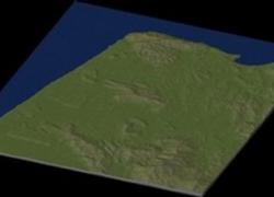
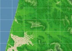
NHP Tangiers Morocco By blade2k5
Map Details and Information
Tangier or Tangiers is a city of northern Morocco with a population of about 700,000 (2008 census). It lies on the North African coast at the western entrance to the Strait of Gibraltar where the Mediterranean meets the Atlantic Ocean off Cape Spartel. It is the capital of the Tangier-Tétouan Region.
The history of Tangier is very rich due to the historical presence of many civilizations and cultures starting from the 5th century BC. Between the period of being a Phoenician town to the independence era around the 1950s, Tangier was a place —and, sometimes a refuge— for many cultural diversities. However, it wasn't until 1923 that Tangier was attributed an international status by foreign colonial powers, thus becoming a destination for many Europeans and non-Europeans alike such as Americans and Indians.
Nowadays, the city is undergoing rapid development and modernization. Projects include new 5-star hotels along the bay, a modern business district called Tangier City Center, a new airport terminal and a new soccer stadium. Tangier's economy will also benefit greatly from the new Tanger-med port.
Map Specifics
Map Type: Real World
Region map size: Map is configured for 42 large city tiles and is 6x7 in size.
config.bmp size: included with zip file
Dependencies: Either SC4 Mapper or SC4 Terraformer for importing.
Maps were created by taking 3 arc elevation data.
To install SC4M map file:
SC4Mapper
1. Unzip this file.
2. Run SC4Mapper, click on 'create region'
3. Choose SC4M
4. Browse to the unzipped folder and point the map file .SC4M
5. Click on 'Save Region' and name it, and Quit SC4Mapper
6. Run SC4 and load the new region. The colors of the region in SC4 will be the same colors as SC4Mapper until you enter and save each city tile. But you have the choice to do it as you go and not right away.
SC4Terraformer
1. Create a new region folder in your Plugins\Region
2. Copy my config.bmp into the folder and overwrite the old one. (make changes to config.bmp file now if you want)
3. Open the new region you just created with SC4 Terraformer
4. Click on Import Image in the Global Tools Menu and browse for my SC4M file.
5. When file is imported click File - Save (the region is now saved to SC4
6. The colors of the region in SC4 will be the same colors as SC4TF until you enter and save each city tile. But you have the choice to do it as you go and not right away.
Start opening tiles!
Credits
blade2k5 - Original map creation, scaling, importing. SC4TF modification.
Check out NHPs Map Catalog forum here.
Check out more maps by blade2k5 and NHP
Any comments and feedback welcomed. Thanks for looking and enjoy.
-
 1
1


