

 Supported


About This File
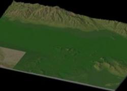
NHP San Bernardino-Riverside Ca. By blade2k5
Map Details and Information
Riverside
Riverside is the largest city in the Inland Empire Metropolitan Area of Southern California, and is approximately 60 miles east of Los Angeles, and 12 miles southwest of San Bernardino. Riverside is the county seat of Riverside County, and is named for its location beside the Santa Ana River. Riverside is the birthplace of the California citrus industry, home of the Mission Inn Hotel, the largest Mission Revival Style building in the United States, and home of the Riverside National Cemetery. As of 2008, Riverside had an estimated population of 311,575.
Riverside is the home of La Sierra University, California Baptist University and the University of California, Riverside, which has a citrus experimental station and a salinity lab. Attractions in the area include Riverside Metropolitan Museum, which houses exhibits and artifacts of local history, the California Museum of Photography and the California Citrus State Historic Park. The Parent Washington Navel Orange Tree, planted in 1873 and one of two original orange trees in California, and the historic Mission Inn are landmarks in the city.
San Bernardino
San Bernardino is a large city located in the Inland Empire Metropolitan Area of Southern California. San Bernardino is also the county seat of San Bernardino County, California, United States. San Bernardino's estimated population, as of 2006, is 205,010. As of 2006, it was the 18th largest city in California, and the 101st largest city in the United States. San Bernardino is part of the Riverside-San Bernardino-Ontario Metropolitan Area, which is the 14th largest in the nation and which is commonly referred to as the "Inland Empire". Though much of the housing stock is, on average, older than that of the surrounding region, new homes continue to be built in different parts of the city, with the bulk rising in the Verdemont area on the north side of the city.
Map Specifics
Map Type: Real World
Region map size: Map is configured for 130 large city tiles and is 13x10 in size.
config.bmp: included with zip file
Dependencies: Either SC4 Mapper or SC4 Terraformer for importing.
Maps were created by taking 1/3 Arc USGS DEM elevation data.
Install/Uninstall Instructions
SC4Mapper
1. Unzip this file.
2. Run SC4Mapper, click on 'create region'
3. Choose SC4M
4. Browse to the unzipped folder and point the map file .SC4M
5. Click on 'Save Region' and name it, and Quit SC4Mapper
6. Run SC4 and load the new region. The colors of the region in SC4 will be the same colors as SC4Mapper until you enter and save each city tile. But you have the choice to do it as you go and not right away.
SC4Terraformer
1. Create a new region folder in your Plugins\Region
2. Copy my config.bmp into the folder and overwrite the old one. (make changes to config.bmp file now if you want)
3. Open the new region you just created with SC4 Terraformer
4. Click on Import Image in the Global Tools Menu and browse for my SC4M file.
5. When file is imported click File - Save (the region is now saved to SC4
6. The colors of the region in SC4 will be the same colors as SC4TF until you enter and save each city tile. But you have the choice to do it as you go and not right away.
Start opening tiles!
Credits
blade2k5 - Original map creation, scaling, importing. SC4TF modification.
Check out NHPs Map Catalog forum here.
Check out more maps by blade2k5 and NHP
Any comments and feedback welcomed. Thanks for looking and enjoy.


