


Entry 22: Neumarkt, Breitenbündt

We are here:

Today's Entry - Introduction:
Long time, no see, I'm glad I'm back again. This year, RL really took much time, and I'm sometimes a person who's horribly stuck with dreaming and thinking of how to pull off my ideas - so, that's the reason why I was away for nearly a year now. Fortunately, I got my wits together in the last few weeks, and so I made another entry, this time dealing with Neumarkt, the city tile north of Sebastianskirch, which has already been featured in the entries 14-17.
I would like to mention today that I've been laying out various projects for the map I'm working on, mostly dealing with terraforming (creating valleys, mountain ridges, rivers and lakes), and the settlements. Today, I'd like to share part of my planning process, at least as far as I'm still having pictures ready. As already mentioned in the introduction of this CJ, in 2020, a stupid mistake on my part forced me to completely redo everything in Maxiland. I'm still having a few overview pictures of the area of this time. This is the area I'm showing off today, as seen on a picture dating back to 2021:

This area is mostly a narrow strip of flat land, squeezed in between two low mountain ridges. I decided to make some terrain changes, the most prominent ones creating a small ridge between both mountain ridges and making two rivers, one flowing to the north (into the lake), one to the south (into the sea), along with digging a deeper valley for the southbound river. This is a makeshift sketch of how I was laying out my plans:
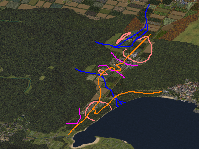
Pink lines: limits of additional hills
Blue lines: rivers, lakes
Light pink lines: settlements
Orange lines: main roads
And after a few weeks of terraforming (the most difficult part), placing lots, and MMP'ing (the most time-consuming part), the overview picture looks like this:

Today's Entry - Contents:
Fortunately, this time, very little historical babbling, so let's just start with the southern settlement, a market community called Neumarkt. Neumarkt has an age of centuries, despite its rather small size. Its location at the intersection of two main roads, all connecting major cities like Sebastianskirch, Eichenwald (to the north, at the lake) and Maxistadt (to the northeast), allowed it to thrive, despite its rather hilly location. In earlier times, its harbour was even more important than the one of Sebastianskirch, although its importance declined over the years.
I should also note that up to the 19th century, the main road leading to the northeast was going over a small covered bridge, but with the advent of motorized traffic, a bigger bridge had to be built, close to the river delta (we'll see it later). In the 20th century, the new railway station and the fact that the intersection of the main roads was now further to the west, encouraged people to settle further to the west - this is the reason why Neumarkt has about three village cores - one near the old harbour which isn't in use anymore, one in the center, close to the church, and one to the west, close to the railway station.

Now a few pictures from the area to the south (at the left of the former picture), where the road connecting Neumarkt and Sebastianskirch is located. By the way, the area of this community is rather hilly, and the hills are only partly settled.


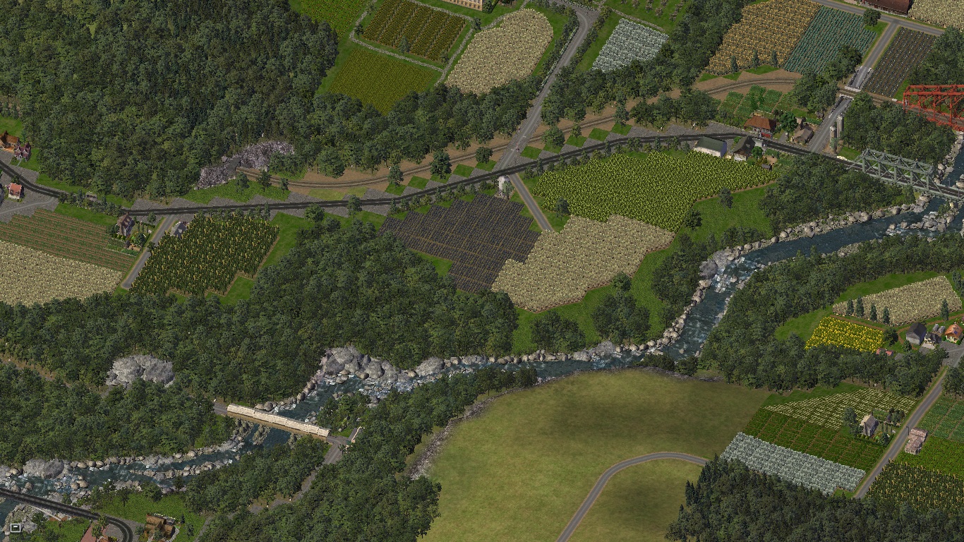
The upper right road (to the north-to-northwest, actually), the federal route B2, is connecting many cities and villages of Maxiland. it is passing through the valley of the river Thurn. Here are two pictures, one of the river itself, and one of its delta that I already showed off in one of the threads here. One can also see the small covered bridge and the larger viaduct over the delta.

During the 19th century, two rich families bought some land in the hills and started farming activities there, as sort of a charity project for poor people. Two pictures, one of the family Kolhof, whose farm is still flourishing today, and one of the family Carolath, who also has a flourishing farm of sorts - growing flowers instead of grains and vegetables today.


We are following the route B2 further to a small hamlet with the name Langen am Thurn. Nothing to tell about it, maybe a farming community, except the fact that the railway is splitting here because the terrain forced me to do so. Two pictures, one of Langen, one of the road climbing further to the north, over a low mountain pass.


And we arrive in the next village, Breitenbündt. This village is also rather unusual in its layout, consisting of three parts - Oberbündt, Unterbündt and Achwaid. Before the 19th century, Oberbündt and Unterbündt were two independent villages, now they are part of the same village. In the 19th century, there only were a few houses in Achwaid, but the rather senic view of the lake there made many people move there in the 20th century. It should also be noted that in the 20th century, people were shifting from animal husbandry to growing plants in the Feldviertel (exactly the opposite of what happened in my country, at least the part I'm living in). This is the reason why there are many open areas of meadows which are partly being reused as farm fields (in fact, "Bündt" is an old German word, mostly in some slangs, for "Meadow").
Two pictures; in the first, Unterbündt is located at the left and Oberbündt (at a slightly higher altitude than Unterbündt) at the right; in the second, Achwaid is below the lake. Also, as you can see, the terrain made it difficult for me to construct a railway line there - it had to be placed literally at the shores of the lake.


And a few close-ups, one of the small brook between Oberbündt and Unterbündt, one of the small castle overlooking the lake.


And that's it for today's entry. I hope you liked it, admittedly, this time nothing extraordinary and special.
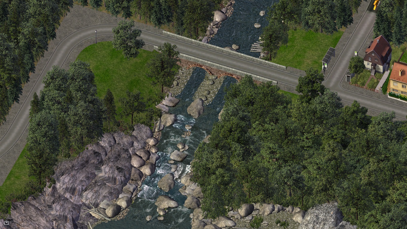
Edit: Due to the server wipeout of Simtropolis in 2026, I'm uploading two extra pictures related to this CJ entry here. I used them as sneak peeks for it, but they do as well fit in here. First, a close-up of the small street bridge connecting Achwaid with the rest of Breitenbündt, next, just a picture of the two bridges close to Langen am Thurn form a different angle.

-
 15
15


7 Comments
Recommended Comments
Sign In or register to comment...
To comment in reply, you must be a community member
Sign In
Already have an account? Sign in here.
Sign In NowCreate an Account
Sign up to join our friendly community. It's easy!
Register a New Account