


Entry 23: Birkenhang

We are here:


Introduction:
The last weeks have been taking me to a different direction I expected: I started developing the eastern tip of the peninsula Sebastianskirch is located (the yellow frame in the picture above). There's only one community there, Birkenhang, but due to the terrain, it is interestingly split up into several smaller hamlets and village parts.
As usual, the historic background: It is unsure when the first humans arrived in this area, but the community of Birkenhang (lit. birch hill), as it is now, literally was formed at a very late year, the year of 1907. It should be noted that in this area, there were several villages and hamlets for a long time, each of them appearing at entirely different times; the eastern tip itself has, however, been called Birkenhang for a pretty long time. In 1907, all of these settlements have been put together to a single community. Here is a sketch of the different parts of Birkenhang at an earlier stage of development (white names: names of village parts, in italics: mountains and hills, in grey: island names, colorful: various building projects):

The most important aspects in the history of Birkenhang and its village parts are related to the fact that people there lived mostly from fishing (there's still a considerable amount of fishing industry there, we'll see about that in a later entry), and, interestingly, military and trade.
You might have noticed the light blue frame in the second picture above. This part of Maxiland is called "Seeviertel", I already mentioned the 4 realms of Maxiland in Entry 4. In the year of 712, at the time between the first and second Empire, military forces from an Arabian-speaking country started taking over the peninsula at the southeast, taking advantage of the fact that there was no coherent Maxiland empire which could have organized a defense against them. It took until the years between 1325-1443, until Maxireich (even the third Empire) was able to take back part of this area (at least the area visible on the map above; the first Empire possessed much larger parts, but those turned into other independent states at about this time).
The close proximity of Birkenhang to the area occupied by Arabian Caliphates made it an ideal staging ground for a counterattack, and thus, in earlier time than nowadays, a military harbor, some barracks (the so-called Kommandantur) and even a huge fortress have been erected, the latter one in case of an attack of those Arabian countries. We'll see about the Kommandantur and the fortress later; for now, I'm concluding the historic background by mentioning that after that, Birkenhang gained some importance in trade between the Seeviertel and the adjacent countried with the rest of Maxiland, and some buildings became cultural centres, such as the fortress itself, the various old village parts and the monastery.
Contents:
Let's first recall this picture from Entry 13, dealing with the village of Weinbach. The road at the upper left, the federal route B2, connects to the easternmost parts of Birkenhang.

We'll start at Klarenbach, the direct connection point, just beyond the border. Two pictures from different angles. It is still a WIP, the adjacent parts haven't been developed yet. Klarenbach is more or less a 19th century expansion at a piece of flat land, and at the intersection (the roundabout) of the B2 with the B7, coming from Michaelshaven over Zirbenbucht to Birkenhang. Agriculture never played an important role in Birkenhang, but as you can see, there are at least a few fields in the little free space available.


First, we continue following the B7 (on the top right of the last picture) to the village part Oberdorf (lit. upper village). The very low amount of wine fields is actually part of Weinbach. The small street at the left of this picture goes all the way to the large fortress.

And a close-up of the Klarenbach spring:
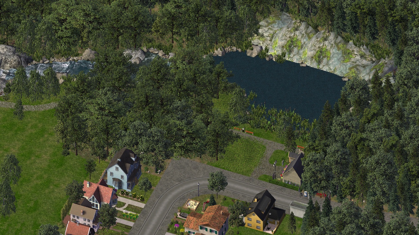
Between Oberdorf and Krabbenfels (see Entry 20), this special spa hotel has been built. It should be noted that there's a small mire nearby, and the hotel's most widely known specialty are mire baths in the mud which is rich in minerals. We'll see more about it later.

Back in Klarenbach, here's a close-up of the park between Klarenbach and the center of Birkenhang, Mariahilf. Unlike my usual way of laying out villages (people in Maxiland like building their houses on slopes), slopes in this village are being used as parks, farmland, or just covered with forest.

Next, we follow the road into the opposite direction, to the village part of Unterdorf (lit. lower village). The old village buildings are witness to the fact that this area once was covered by several small settlements. Two pictures, the second one is a close-up of the old village and the beach. I should note that I chose these old town buildings because I think they fit with the style, but unfortunately, they're a bit large compared to the rest of the buildings here.


The coastline quickly gets more rugged, but as you can see, this didn't stop some farmers from at least deploying a few farm fields on what little flat or smooth land this area had to offer. By the way, I took inspiration for these pictures from a CJ from here, Kanin Fjord.


And we arrive in the most peripheral village part of Birkenhang, Spitz (this just means tip), owing its name to its twisted landscape. This area has been living from fishing for a very long time and is most likely actually the oldest village part of Birkenhang. First, two pictures from different angles:
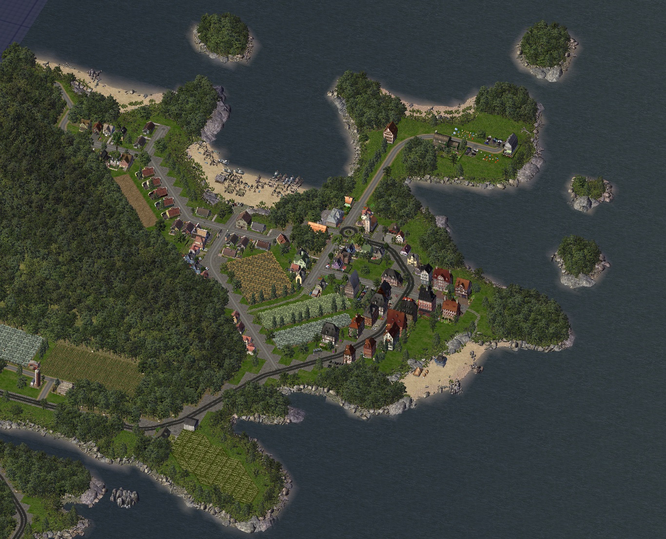
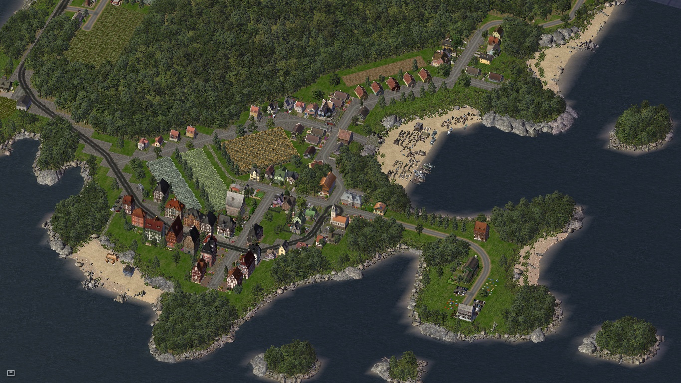
And three close-ups: First, the old village parts.

Second, the so-called Angler's land, a small peninsula which now only contains a single house, a restaurant, and the local anglers' club, and is a very popular recreational area.

Third, the beach of the fishing people still practicing some traditional fishing.

And that's it for today. There's still a lot to do in Birkenhang - the village parts of Eschenfall, Mariahilf and Außerdorf, as well as the fortress and the mire are remaining on the mainland; furthermore, the 5 islands of Langland (with a mesa and a lighthouse), Einsiedeln (with the mayor's villa), Sonnenau (with the monastery), Windau (an uninhabited island, the remains of a caldera), and Grünau (a very flat sand island) remain. Hope you liked it.

-
 13
13
-
 1
1


5 Comments
Recommended Comments
Sign In or register to comment...
To comment in reply, you must be a community member
Sign In
Already have an account? Sign in here.
Sign In NowCreate an Account
Sign up to join our friendly community. It's easy!
Register a New Account