



23. A B C D

It is a rare opportunity to develope a city from scratch on a vast, undeveloped flat land, while at the same time having a strong financial support. But in Alpine City's case, we have such a chance. The city treasury still have enough reserves to allow construction of infrastructures at a colossal level, that the entire city is planned concurrently.
That means mega-structures and integrated planning becomes possible. Several years after the reclamation, the city council is already on hand with the master planning of the new city. 
Construction works for utilities, like power cables, pipe lines and roads has begun. Several strucrtures, such as fire stations, police stations and a hospital has already been finished in the New City. 
Below is the top view of the New City area. 
There are several strategies in the planning of New City.
1. City-scale green belts
Reclaimed lands are expensive to build, thus require high building density to make it worthy. But at the same time we don't want a congested mess of highrises.
The solution is to cut the city up into sectors, and between them, infill with gigantic green belts. New City will be divided into 4 zones: A, B, C, and D. Between them will be 100m-wide green belts. (in yellow on the plan below). These green belts are intended to improve wind flow, increase day light penetration and provide social and leisure space for the city.
The coastal area and buffer zone between city and the mountain will also be built into green belts.
2. City Nodes
Certain area will serve as nodes (in red on the plan below), namely the two new train stations, the central grand roundabout that connects all 4 zones, and the landmark area at the tip of the peninsular. These will be transportation hubs or area with special scenic value.

3. Transportation planning
The old town of Rosewood and Newgrounds remains the core of Alpine City, and the New City must be well connected with them. Both the train and highway systems are expanded to connect the New City with existing city centers.
Again, the reclaimed land is too valuable to be occupied by highways, thus all highways will be built underground, same as Newgrounds. The underground highway runs directly under the green belts, with exits and entrances connecting all the Zones.
The train system also extends from Newgrounds up to New City. Two new stations are built in the area. In the future, the railroad will be extended further to connect Irindale. The new train stations will contain bus stations and new tram track as secondary connections with all 4 Zones. 
4. Avoid visual impact towards the Old Town
Rosewood's tourism is built on its old town vibe. While New City is a mountain away from it, highrises may still be visible from Rosewood, disrupting the view. Therefore a strict height restriction will be imposed. 

Now, let's travel around New City to see the latest development. The train tracks up to New City Station has been constructed.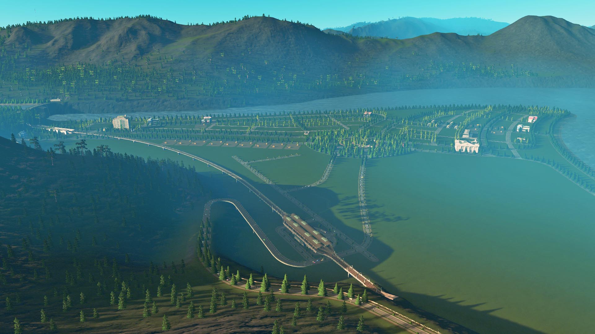
Though right now the New City is still empty. But in time these train stations will become major transporation hubs.
Below is the South City Station, at the southern edge of New City, sitting on the area that was once the Tenpine Forestry Indsutrial Zone. The railroad tracks are all elevated in New City to avoid road intersections.
Two cable car terminals are built right next to the train station - they will become useful when Mt Lilac is developed. Though that will take some years. 


All 4 Zones of New City will be further connected by trams. The train stations are integrated with tram tracks and bus terminals.
Below is the New City Station. It has 4 tracks, allowing both local and rapid trains. Intercity trains can also stop here once the tracks are linked up to Irindale. 
The grand roundabout is located at the very center of New City, at the intersection point of green belts. Drivers can access or exit from the underground highway here. The roundabout is further linked with 8 nos. of 6 lanes avenues, 2 for each Zone. This roundabout will certainly become a landmark for New City. 

The coastal promenade has been compelted. The below spot is at the tip of New City, in which a landmark structure will be built here to mark the very pinnacle of the city. 
The city fabric can be better visualized under night lights. 

Zone A and B will be the first areas to be developed. Depends on the demands of commercial, office or residential zones, the land uses for Zone C and D will be fine tuned accordingly. There are also plans to develope the relatively flat summit of Mt Lilac to the east parallely.
Latest city map and transportation map:

-
 6
6


1 Comment
Recommended Comments
Sign In or register to comment...
To comment in reply, you must be a community member
Sign In
Already have an account? Sign in here.
Sign In NowCreate an Account
Sign up to join our friendly community. It's easy!
Register a New Account