Jump to content
  •   Announcement

  • Entries
    69
  • Comments
    344
  • Views
    57,498

San Lorenzo Overview - St. Raphael

Sign In to follow this  
panthersimcity4

322 Views

Here's a satelite picture of the city, which I will add to the first post:

SantaRosaIslandsjjjggg.jpg

Idk what happened on the bottom...heheh.

This update is about St. Raphael, the area just south of Downtown across Paraiso Harbor. To be honest, initially I found this area to be really dull, but once I started building more buildings I have to say now it's one of my favorite parts of the entire city.

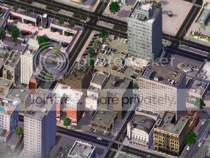
At the top of the mosaic is the St. Raphael Marina and Harborside Shopping Center, which includes the Oahu Nightclub and a building with loads of fashion stores. The subterranean mall across the avenue has assorted shops and a foodcourt with several shops located underneath the nearby SLH Health Building (the blockish office building with the expansive parking garage attached to it)

San-Lorenzo-Sep_01.jpgSan-Lorenzo-Sep_02.jpg

San-Lorenzo-Sep_03.jpg

This part of the city was originally founded as "San Rafael" by Spanish explorers, and when the Americans came in it was renamed St. Raphael. For years this area was just a backwater fishing town, but as the city of San Lorenzo expanded in the late 1800's and many immigrants from Ireland and Italy began to move into the central business district, many xenophobic wealthy people did not want to associate themselves with the immigrants, so they built nice mansions in this area, some of which are still there. They would ban any immigrants from living in the area, as they felt they were inferior and therefore did not want to live anywhere near them. However, in a somewhat satisfying ironic twist of fate, this area would become almost predominatelly filled with expatriate immigrants, most of them from Greece and Balkan countries.

SanLorenzo-Sep1401252704426-1.jpg

Here, for example you have the Greek Orthodox St. Theodosius church and a nearby Gyros cafe. This area has alot of wonderful Greek cuisine, and if there's one thing that San Lorenzinos appreciate... it's yummy food. Of course alongside the Greek cuisine is different types of food like McDonald's, ChickenTacoLand or McGreasy's.

SanLorenzo-Sep1401252704537.jpg

Of course there is another side to this area... and I'm not talking about the greasy food at ChickenTacoLand. There's some seedy "entertainment" venues located a bit south of the central area of St. Raphael... where desperate men go to excite themselves. Whatever the reason people even go to those places, rest assured most of the joints here aren't affiliated in anyway with the local community.

And to end the update, another nighttime picture:

SanLorenzo-Sep14DD01252704389.jpg


Thank you for reading this update, brought to you by....

Untitled-1xbcvbfcopy.jpg

*Technically. We keep it frozen and heat it up in a microwave... it’s not like you’ll be able to tell anyways since you're probably used to eating TV Dinners. 3.gif

Also, it's 9/11, so let's remember those who perished. 15.gif

Sign In to follow this  


9 Comments


Recommended Comments

Thanks for the comment jamonbread, I can see what you mean, but that's the size the game made it and I figure it gives more space to show more stuff. BTW I love your name... I love ham lol

Share this comment


Link to comment
That region shot perspective is very nice.  Heh, I haven't seen seedy entertainment venues in a city journal until now.  Also, those PEG docks are one of many things I've been looking for.

Share this comment


Link to comment
sumwonyuno: lol thanks, I added them as sort of a realistic touch, of course not because I would have any interest in those kind of venues. 
Evillions: What I did was sort of make the shape of the picture stretched more vertically... you see, if you were to view the cities from top-down view the city boundaries would be perfect squares (as can be noticed on a region config.bmp) so what you do is stretch the picture vertically until you notice that it looks like a square, then rotate it around so it's upright... at least that's how I remember it, it might be a little more complicated.

Share this comment


Link to comment
 The overhead view reminds me of a Grand Theft Auto map lol. Looks amazing. I'm a bit late to the party :P

Share this comment


Link to comment
Excellent stuff you have produced sir!
Just wondering, how did you get the island's coast line to be perfectly (relatively speaking) straight?

Share this comment


Link to comment
[quote name='patriotizzy' timestamp='1276126976']
The overhead view reminds me of a Grand Theft Auto map lol. Looks amazing. I'm a bit late to the party :P
[/quote]


That's what i was thinking. it kinda remembers the GTA 3 map!


LOL! 2 YEARS AFER A REPLY! LOL!

Share this comment


Link to comment

Sign In or register to comment...

To comment in reply, you must be a community member

Sign In  

Already have an account? Sign in here.

Sign In Now

Create an Account  

Sign up to join our friendly community. It's easy!  

Register a New Account

×

Thank You for the Continued Support!

Simtropolis depends on donations to fund site maintenance costs.
Without your support, we just would not be in our 24th year online!  You really help make this a great community. *:thumb:

But we still need your support to stay online. If you're able to, please consider a donation to help us stay up and running. This helps sustain a platform where we can share our community creations for years to come.

Make a Donation, Get a Gift!

Expand your city with the best from the Simtropolis Exchange.
Make a Donation and get one or all three discs today!

STEX Collections

By way of a "Thank You" gift, we'd like to send you our STEX Collector's DVD. It's some of the best buildings, lots, maps and mods collected for you over the years. Check out the STEX Collections for more info.

Each donation helps keep Simtropolis online, open and free!

Thank you for reading and enjoy the site!

More About STEX Collections