

Hi There Neighbor

The Greater Bay region has grown! As usual, for those of you who like to see and explore the area, <a href="https://s839.photobucket.com/albums/zz319/Ragnoff/SimCity%20Greater%20Bay/Roads%20and%20Ferries/">this folder</a> on photo bucket contains the most recent set of pictures.
In my imagination this period is about 60 years after the first update, and this is still the preparation part of the region.
<img width="701" height="363" alt="" src="https://i839.photobucket.com/albums/zz319/Ragnoff/SimCity%20Greater%20Bay/Roads%20and%20Ferries/GreaterBayRegion2-1.jpg" />
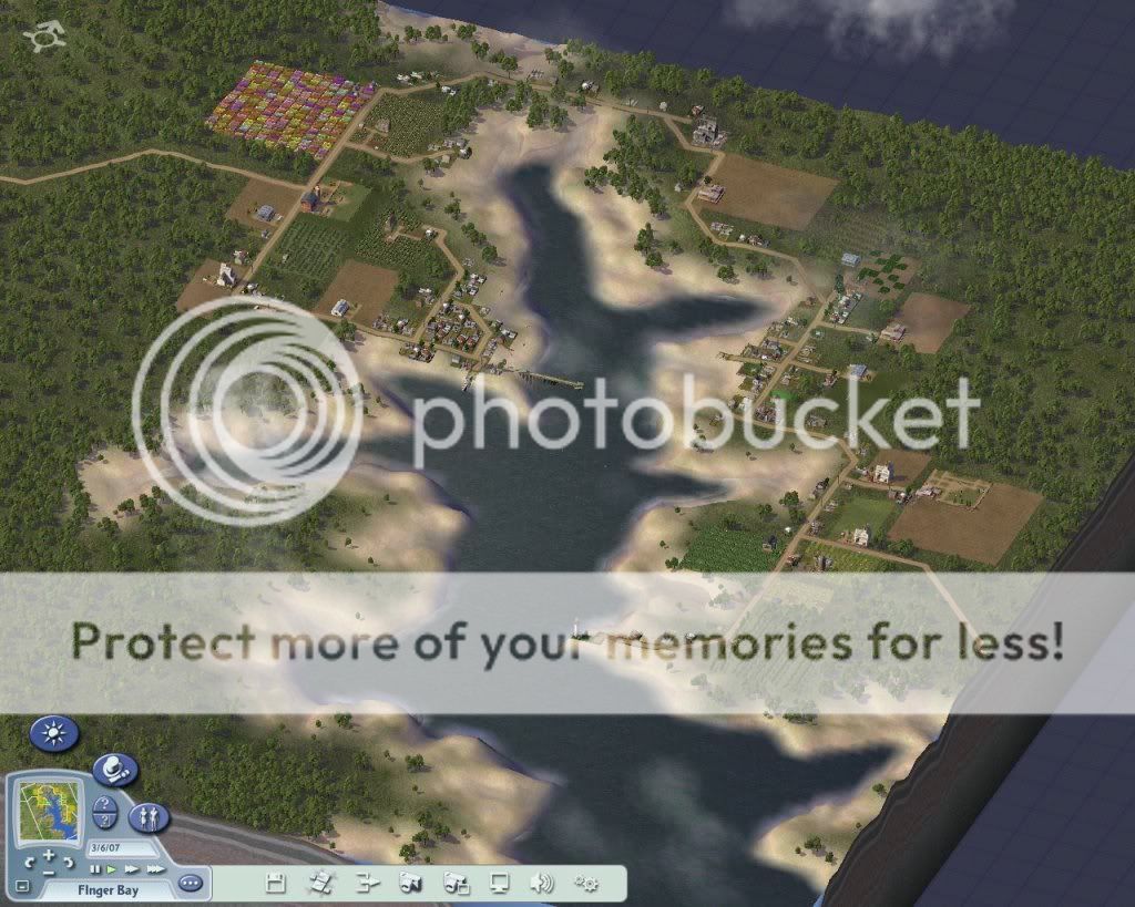
The region population has increased significantly, it is up to just over 7000, and each of the nine starting villages now boasts a pontoon ferry. Again the pontoon ferry is the closest approximation of the early exchange by boat that would have gone on. I do believe that in one form or another there would continue to be boat travel. Also visible are the roads, actually streets except for the neighbor connection, connecting several villages. These represent the initial dirt trails connecting those villages. The population increase was mostly concentrated in small residential housing filling in the gaps between the initial houses at the coastlines, coupled with a little more growth near farms or streets in each case.
The first neighbors that I would like to show you is the Finger Bay Village area and Laurel Point, the closest neighbors on the north side of the bay entrance.
<span style="font-size: x-large; "><u><strong>Finger Bay
</strong></u></span>
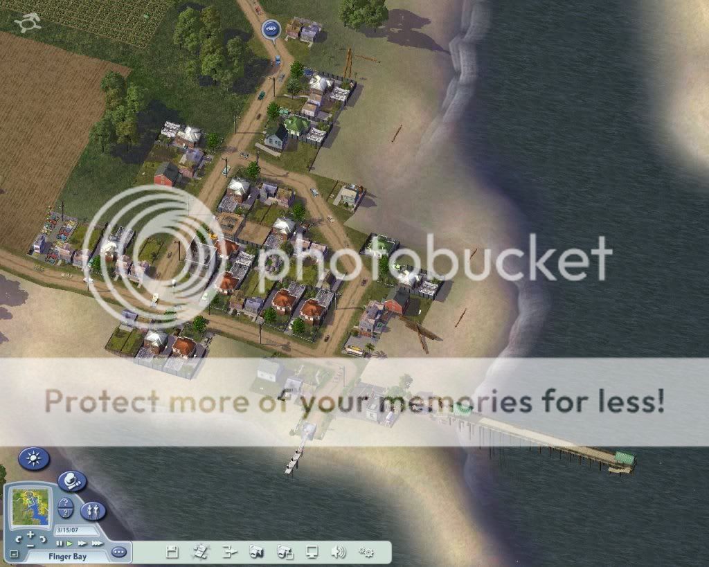
Finger Bay is actually a misnomer, one that angers the local residents considerably. Specifically, Finger Bay is the name of the finger of the bay that stretches north from the main bay entrance.
<img width="800" height="640" alt="" src="https://i839.photobucket.com/albums/zz319/Ragnoff/SimCity%20Greater%20Bay/Roads%20and%20Ferries/FingerBayFerry.jpg" />
There is actually a small community on the west bank, a second small community on the east bank, and number of homesteads and farmsteads scattered around the bay. The main reasons others refer to this as the Finger Bay Area or Finger Bay Village is that depending on who you talk to on any given day the local name for the area changes. John Smithson, for instance, says everyone refers to the area as Johnstown because he owns the only small industry in the area, old lady Cottonton claims of West Bay is known as Cotton Acres, as her family's farm was the first one there. The name of the little community is on the east and west bank changed based on who's acting as mayor that week, month or rarely year.
These folk are an independent sort you see! Although less polite folks call them other things, stubborn, foolish, you get the picture. One thing is certain, the existence of Smithson metals as one of the only places you could originally get anything more complicated than nails or horseshoes did make this one of the most populated areas initially! Here is the West Area of WhatEverTheNameMayBe with the docks.
<img height="480" width="600" alt="" src="https://i839.photobucket.com/albums/zz319/Ragnoff/SimCity%20Greater%20Bay/Roads%20and%20Ferries/FingerBayFerryCloseUp.jpg" />
Until and unless the local residents can get together and start telling outsiders the same name, the area will continue to be known as Finger Bay!
<span style="font-size: x-large; "><u><strong>Laurel Point
</strong></u></span>
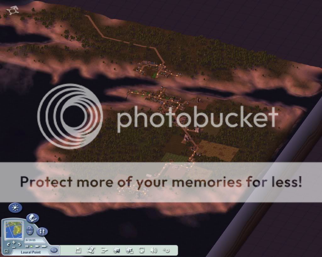
Laurel point is a pseudo-Island just off the main Bay. It is a pseudo-Island because during the driest times and the lowest tides, you can walk across the small channel to the mainland.
<img width="800" height="640" alt="" src="https://i839.photobucket.com/albums/zz319/Ragnoff/SimCity%20Greater%20Bay/Roads%20and%20Ferries/LauralPointFerry.jpg" />
Back when everyone traveled by horse or buggy, this was sufficient. This somewhat difficult to build streets in locations that often have 2 feet of water covering them, so for the most part initially this small self-contained community has very little trade with the Finger Bay area. There was a small low area that basically traveled across the center of the island. The initial settlers followed this across from one shore of the island near the channel to the outer shore, and this later developed the road which most of the farms were built along. Laurel point has two separate community centers, the larger one is near the connection to the mainland (shown below), this is where the pontoon pier is built.
<img width="600" height="480" alt="" src="https://i839.photobucket.com/albums/zz319/Ragnoff/SimCity%20Greater%20Bay/Roads%20and%20Ferries/LauralPointFerryClose.jpg" />
A smaller cluster was built on the outer shore, originally founded by Mr. Brandon, who just really didn't like anybody else in the village. He was most disappointed when others thought his new location was a great place to put it in a small amount of industry. Legend says he was last seen stomping off up the dirt path towards Finger Bay. There are also a few souls who decided instead of waiting for the water to go down they would just build dwellings across the channel. At the moment, those people are still considered part of Laurel Point, but that may not last.
Next Update we will look at the three settlements on the south side of the bay entrance!<br type="_moz" />

1 Comment
Recommended Comments
Sign In or register to comment...
To comment in reply, you must be a community member
Sign In
Already have an account? Sign in here.
Sign In NowCreate an Account
Sign up to join our friendly community. It's easy!
Register a New Account