


Shepherding the vanilla commuters

Whether playing in vanilla or with NAM, but even more so in vanilla, it really does help to think of cities/regions as a superorganism with the transport network as an analog for plant xylems, blood vessels, or lung bronchi - transporting people instead of water/blood/oxygen throughout the body. The key difference with real life is that people are independently capable of planning their own routes, while mindless water/blood/oxygen/ particles follow the path of least resistance. Then again SC4 is not real life, which is especially the case in vanilla, where the commuters act more like mindless particles, arguably even stupider since the vanilla commuters insist on taking the absolute shortest path despite the congestion, whereas water/blood/oxygen particles “know” to use alternate routes where available if the pressure at the main/shortest route gets too high.
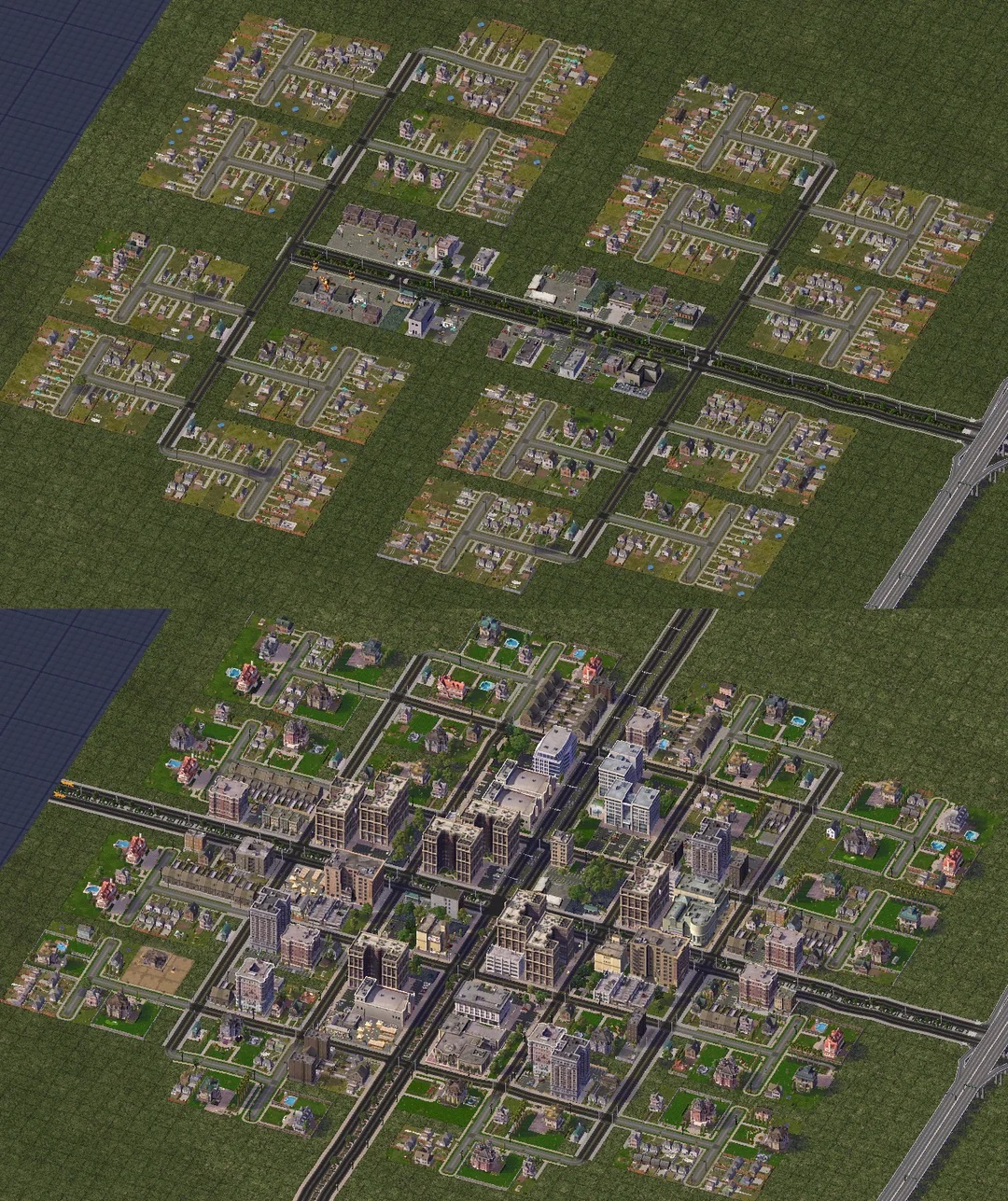
Using the "biological superorganism" idea, I started off trying tree-like layouts that could be later adapted for medium/high density development with more transit options. It worked reasonably well initially but I found it kinda limiting, so I reverted back to the standard grid but kept the hierarchy of transit options as in the following screencaps.

The Dauper-Ragako metropolitan area’s high-density mixed-use residential and commercial districts

Buses plying one-way street grids undergirded by diagonal subway lines, serviced by a monorail trunk line and elevated highway. The bus stops are placed with offsets on every other city block so they’re not all stuck travelling in the same direction lol.

Diagonal subways underground to complement the orthogonal street grid above ground
Brzenska city’s unconventional “fractal grid” plan, inspired by the real-world Barcelona city grid. Basically the tree layout described above taken to the extreme, rolled up and folded alongside each other. The idea was to selectively remove some of the interior four-way street crossings to force vehicles out onto the exterior higher-capacity roads. Then continue up the road hierarchy with more roads/avenues/highways in a sort of fractal pattern, with diagonal subways as shortcuts to discourage road congestion & encourage mass transit usage. Put another way, we’re sacrificing fast commute times to minimize congestion at intersections.

Default view of one corner of the city. The inner->outer road hierarchy I ended up using was street, road, avenue, avenue, highway. I think I could have gotten away with street, road, road, avenue, highway

Zone view. Alternately we could have tried using under-/over-passes for some of the avenue crossings instead as a middle ground

Subway volume. The thing about square grids is that it lends itself well to having subways cut across the diagonals

Traffic congestion. For the inner streets I tried to micromanage the 3x3 res plots so that they point away from each other and have a dedicated street for themselves, but then they went through the sides and back of the buildings so that didn't work

0 Comments
Recommended Comments
There are no comments to display.
Sign In or register to comment...
To comment in reply, you must be a community member
Sign In
Already have an account? Sign in here.
Sign In NowCreate an Account
Sign up to join our friendly community. It's easy!
Register a New Account