



11. The Past, Present and Future

Alpine City has gone a long way from begining to what it is now. Let's begin this entry with a little recap.
What follows would be a series of photo montage. Two photos will be shown side-by-side, taken at the exact same spot, but in different time.
Let's begin with the town of Rosewood itself.

The Rosewood Baseball Park hasn't changed at all since the beginning. However, the view towards the Castle Peak surely has changed, with the gigantic Rosewood Castle standing on the mountain slope.
The next landmark is the Rosewood Church. The church and nearby buildings haven't changed at all. The only different is the huge mine behind the mountain.


The above two images are taken near Rosewood Town Hall. Some city blocks has increased in density, and the Rosewood Ave. has widened up. Of course, the view towards Castle Peak has been altered by the Rosewood Castle and the Summit Castle yet again.

The Castle Peak was once a remote area. Now it is preserved as part of the Castle Peak Country Park. 
Castle Terrace was originally a slope site above Rosewood. It was the first ever satellite town developed. Now it has totally reworked into a small town, with the infamous Rosewood Castle.

A perspective from the Summit Castle. Alpine City used to consist solely of Rosewood. Now it is a sprawling city with Cratercove, Diamond valley and several other satellite towns.

One of the most significant change is of course the development of Cratercove. Back in the days, people cannot even cross the Rosewood River. Now there are 2 bridges and 1 set of highway that cross the river. The landscape is forever changed by the Cratercove Mine.

Further away from the town center, there are several large satellite towns built over the years. Nine Pine Heights is one of the example.

Sunrise Summit - so far away from Rosewood that most people don't even considered it as part of the city. Once developed into a tourist spot, now has changed into a satellite town.

Once the city is served only with one external highway connection point, near Magnolia Hills. Now there are 3 more highway connections in total. The power plant has also been upgraded into nuclear.
The city's growth is also shown on the map. Below is the map from our first entry. The city consisted of only Rosewood and Magnolia Hills.

And this is the city map now. See how much the city has grown over the years.

And so, we have recap the history of Alpine City since our first entry. Now, let's look into the future.
Now that there aren't much financial concerns, thanks to the profits from Cratercove Mine, the city can afford really huge projects. The future plan of the city is as below:

1. First, a huge reclamation project, forming a large piece of new land over Magnolia River
The soil came partially from the excavation from Cratercove Mine. Magnolia River is a branch of Rosewood river down streams. After study, the northern stream alone can take up the flow of water, so it should be feasible to close off Magnolia River.
This piece of land will double the flat area available to the city. If fully utilized, it can potentially double the population for Alpine City.
2. New highway (Phase 3)
The Phase 2 highway connected Westdale with Magnolia, but only goes in one direction. A new highway will complete the highway loop, forming a ring that circulates the entire city. The route should follow the red line marked on the map.


3. New dam at Rosewood River
Once Magnolia river is closed off, the water that runs northward will double in volume. The power of the water flow can be harvest if we install a hydro-electric dam. Of course, the height of the dam must be carefully adjusted. Surely we don't want Rosewood and Cratercove to be flooded.

4. New town at Ten Pine and Irindale
Ten Pine is a flat area north of the city, having a long coast line with the Great Lake. The forest there can be utilized into forestry industry. Irindale is a deep valley further up north of Ten Pine. The reason for going this far is that it has a railway connection. If we can connect the railway somehow, we can attract a lot more tourists.

The works at Magnolia River has began already. Two dams are erected to close off the river from Rosewood River and Castle Peak River. The water is then pumped out of the mid section, exposing the river bed.
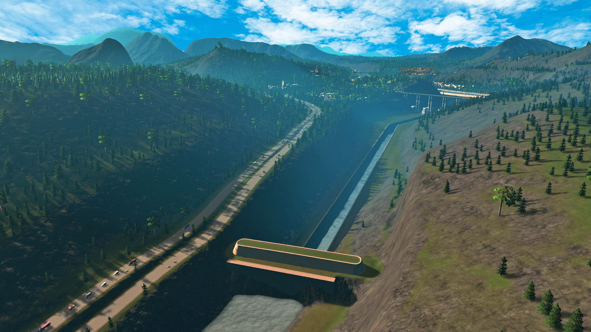

The bridge connecting Nine Pine Heights shall remain to keep the town connected. The new land will then be filled up to Nine Pine Height's ground level. Once done, the bridge will be dismantled.
The closing off of Magnolia River has shown some effects in the water dynamic. Further down streams, there are floods occurring in Ten Pines due to the increased flow. But the flood should be temporary and will subside once the flow has stabilized. 
In our next entry, we will see more on the devleopment on the new land.
-
 6
6


2 Comments
Recommended Comments
Sign In or register to comment...
To comment in reply, you must be a community member
Sign In
Already have an account? Sign in here.
Sign In NowCreate an Account
Sign up to join our friendly community. It's easy!
Register a New Account