


Gathering resources

This is my first entry and my first every journal, so I will introduce my goals! I am planning to recreate the Greater Toronto Area (the city of Toronto and its neighbours) in full scale. I am a resident of Toronto and have had some experience with creating real cities on SC4. I don't know how large it will get or how detailed yet, but let's start things off. First up, I need a map. The last time I recreated a city (Exeter, England) I was fortunate enough to have digital terrain models (DTM) of the area on my laptop. This time, I don't have such and since Toronto is such a big place, there are several maps out there already. So I stumbled across this one from dobdriver https://www.sc4devotion.com/csxlex/lex_filedesc.php?lotGET=2827 . This map is exceptional: it contains a huge area, has smooth terrain, and has rivers. Finally, it has been rotated so that Toronto's "north-south/east-west" transport grid aligns orthogonaly. So before I even begin my work, thanks to dobdriver!
The next step is where to start. I live in the Etobicoke-Lakeshore area of Toronto and this is where I'd be most interested to recreate. Logically, downtown would come first. However, the lack of industry would stunt the growth of any development. Etobicoke-Lakeshore has a great mix of industry, commerce and houses, as shown by this land-use map http://www1.toronto.ca/city_of_toronto/city_planning/zoning__environment/files/pdf/city-wide_allzones_569-2013.pdf (the area is located in the very south-west corner of the city of Toronto's boundary).
Now I will create a transport map that can be referred to while constructing the city. This rather small image below was taken from dobdriver's map's description page. It's a crop of the city tile that represents Etobicoke-Lakeshore.

Then I took a few screenshots from OpenStreetMap of the rough area in question. After stitching them together and rotating them 16.8 degrees clockwise (remember, this is because of Toronto's street grid) I came up with the following map, which contains railways, highways/roads/avenues, streets, transit stops, and green space. I also included an unrotated scale measure for later use.

Now I overlay one ontop of the other in Photoshop. I used the transport map as my background and inserted the city tile terrain map ontop in a semi-transparent layer. According to my scale, there are 74 pixels per 500 m. Knowing that a tile is 4,096 m wide, the tile should be 606 pixels wide to be full sized, so I increased it to these dimensions. Then I moved the image around until it aligned with the coastline on the transport map (shown below). The crescent shaped harbour was very helpful in using as a reference point too. Then just crop it and hide the terrain overlay.
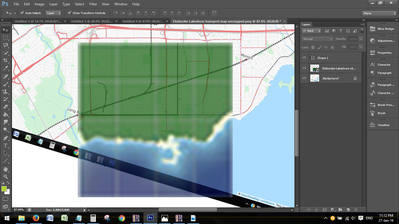
With this map, I am able to start marking the locations of key transport routes such as rail and highways. I will show in detail how one can do this in the next post.


0 Comments
Recommended Comments
There are no comments to display.
Sign In or register to comment...
To comment in reply, you must be a community member
Sign In
Already have an account? Sign in here.
Sign In NowCreate an Account
Sign up to join our friendly community. It's easy!
Register a New Account