

Constangeles Metro Area Map

Here is the map of Constangeles Metro Are.
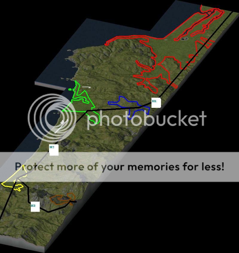
(I use the Canon Beach map)
With red we have Constangeles (center of commerce, toursim, business and HT and manufacturing industry).
With blue we hae the village of Adamclisi. (medium agrivultural only village
With green we have Medgidia city (a large industrial city, with high pollution and an industrial seaport).
With yellow we have Callatis resort. (a small seaside resort city with lot of green spaces, a shopping mall and no industry other than tourism and some small corn fields)
With brown we have Anghel Saligny resort (a very small mountain and ski resort with a small village next to it).
With black we have the 3 major highways : H1, H2 and H3.
With grey we have Mihail Kogalniceanu International Airport and Tuzla Airport (a smaller local airport).
H1 highway is finished and now I am working on Constangeles. It's a very large city (4 large cty tiles) so it will take some time to develop.
(picture made by a friend - Diana)
-
 1
1

2 Comments
Recommended Comments
Sign In or register to comment...
To comment in reply, you must be a community member
Sign In
Already have an account? Sign in here.
Sign In NowCreate an Account
Sign up to join our friendly community. It's easy!
Register a New Account