



Bahía Medusa, part 1

From small, sleepy town to bursting bedroom community, to a town in its own right, Bahía Medusa hosts Looking for Sponsors International airport and, for this reason, is for many, the very first thing they see in Isla Bonita.

A composite image of Bahía Medusa from space
General information
City name: Bahía Medusa
Date of foundation: 1920
Population: 308,892
Size: 16 sq km.
Land area: 70ish?%
Average income: 60k/person/year.
History
Early years
To the east of Presidio Hill, in Anclaje, lays a wide, low-lying valley. Anclaje succesfully managed to lay claim to the eastern part of this valley, near the city, but areas on the east were deemed much less valuable on account of a large sea inlet, punctuated by mudflats, that diminished the land's agricultural value. This bay, little more than a puddle by depth, gained the name of Bahía Medusa ("Jellyfish Bay", in Spanish) on account of the jellyfish that were once very common there.
Despite the low-laying, easily floodable geography, or perhaps because of that, Bahía Medusa earned a reputation as a beach town. It was far enough from the busy Anclaje port to remain quiet and sleepy, yet close enough for day trips –especially with the development of the old Coast Tram–; the abundant sea water moderated temperatures in the sweltering summer and the gently sloping beaches, once the jellyfish nuisance was dealt with, made for relaxing beaches with few of the dangers of some other beaches, more exposed to the open sea. The main town developed right beyond the border from Anclaje, tucked between it and the sea, and the central station was –with great foresight now, but somewhat uncomfortably then– built at the then edge of town. There was also the old Royal Summer Palace, further away, as a retreat for the then King and his family.

The old town, built on the continuation of Valenti Boulevard from Anclaje, with residential zones to the south (right) and a small commercial downtown to the north
Bahía Medusa gets put in the map
The fate of Bahía Medusa changed with the development of air travel. The then new regime at Isla Bonita, which had first hurt the town by expropriating and demolishing the old Royal Palace, approved the construction of an airport on a large, low-lying island in Bahía Medusa – land that was no good for agriculture and remained unpopulated, yet was near enough to the main population centre that it would serve as a convenient destination for international travellers. The King Bonito airport, as it was known was then, started building in the 70s, right as the Oil Crisis hit worldwide. Nevertheless, the government pressed on, and the amount of funds poured into this project, plus the lack of jobs elsewhere, quickly pushed people into Bahía Medusa. The benefits didn't last long –once the single-runway, single-terminal airport was finished, the amount of money entering Bahía Medusa quickly dwindled– but the transportation infrastructure had a welcome side effect: now the city was closer than ever to Anclaje. Further compounding this, the main port had finally finished expanding its urban area to its city limits.
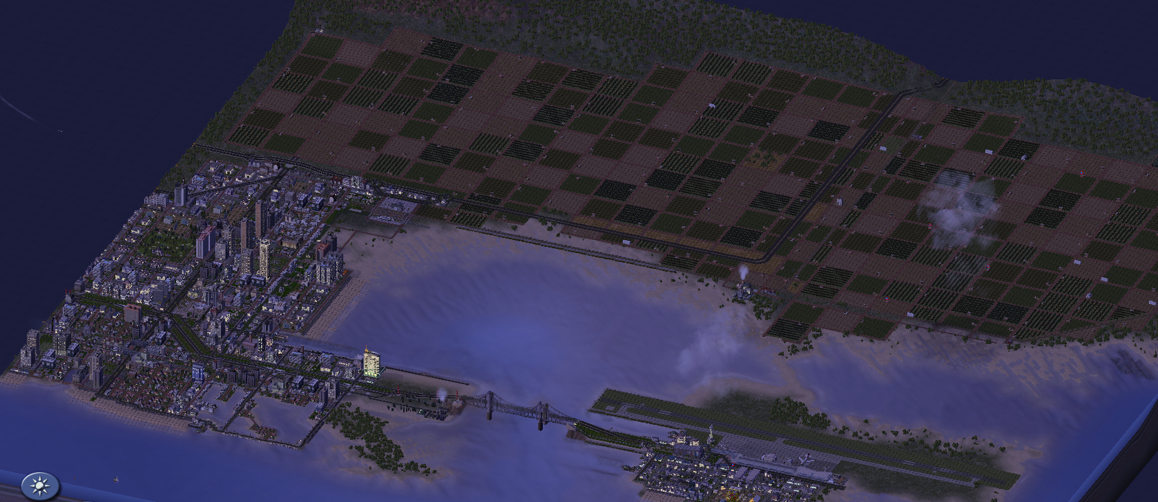
Bahía Medusa with Looking for Sponsors airport finished. The old Summer Palace and hunting fields had been expropriated and demolished by then
Explosive growth and Haussmanisation
Anclaje had already expanded to the west, in the direction of Cuerno de Águila and Bahía Herradura, but there wasn't much space in this direction due to the mountain ranges and the sea. North, to Interior, it was also difficult to expand due to the ruggedness of the terrain. The only way to go was east. The former fields of Bahía Medusa quickly fell victim to rapid urbanization. Eventually, the entire city area would be built up, save from some pockets at the far east. It was by this time that it was decided to reestablish the old Royal Hunting Grounds as a park, as well as rebuilding some of the buildings for public use, but even with these measures, as well as the extension of both Subway Line 1 and Tram Line 3, Bahía Medusa quickly became cramped and overpopulated. For a while, it was the most populous city in all of Isla Bonita, with over 500,000 residents – but despite the development of its own downtown, plus the Free Zone of LFS Airport, most people commuted to Anclaje or beyond. In addition, the tall buildings represented a hazard to the ever increasing flights arriving to and departing the island.
The popularisation of wide-body aircraft and the necessity of a second runway, with included demolitions to make up space for takeoffs, led to a council meeting and one of the most controversial decisions in Isla Bonita urbanist history. By a small majority, it was decided that the new building height restrictions wouldn't just apply on the neighbourhoods on the flight part (the Old Town, for the most part) but everywhere in the city, and they would be retroactive. It was also decided to redraw several streets, departing from the old 130x130 grid that still is dominant in Anclaje and the other cities, in favour of a rectangular approach, and the City Council laid down strict rules regarding the new buildings to be built, which were to resemble the famous Parisian architecture of the nineteenth century.
The decision would prove costly, not only in terms of compensation and expropriations, but also in a diminished tax base that forced the City Council to raise taxes. However, it would ultimately be very successful – the transportation system saw marked reductions in crush time and an improvement in quality and speed, and the city –which was already fairly wealthy and posh– maintained its economic position. The aesthetic changes have also contributed to giving Bahía Medusa an European flair, with mid-rise buildings flanking wide, green boulevards. There remains issues regarding the very expensive rate, and the commuting time is still fairly high for a suburb a mere 5 kilometers from its main downtown at Anclaje, but Bahía Medusa remains one of the most attractive cities for tourists and residents alike.
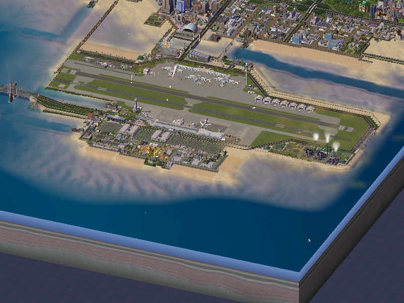
Looking for Sponsors airport is still looking for sponsors to be named!
Geography and climate
Bahía Medusa is located around its namesake bay, a shallow inlet of sea which greatly moderates temperatures around it. It has some hills to the north and northwest, but for the most part, it's an exceptionally flat town, with gentle, shallow coasts. There's been plenty of reclamation around it, especially around the south of the city, where the Laguna and Peninsula neighbourhoods are built practically over water.
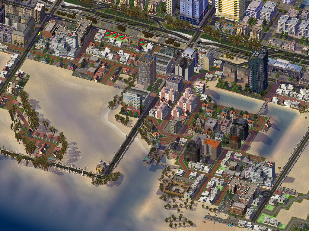
Peninsula, famous for its palms and walkways over water
Transportation
As a suburb of Anclaje, Bahía Medusa's transportation network is geared towards this port town to its west. Nevertheless, it has grown enough in importance that some recent transportation projects have been built in consideration of intra-city travel.
Rail
Served by the Anclaje Docklands line, Bahía Medusa is crisscrossed by two lines. The most important, from west to east, is a double-track railway calling at the Estación de Bahía Medusa, a.k.a. BM Central, and Diagonal station on its way to Cabo Feliz on the far west of the island. There's also a north-south line that starts at Airport Terminal 2 and heads north into Costa Este and destinations beyond.
There's a number of reasons why Bahía Medusa is not a big rail destination. One is the location of its central station, nowadays anchoring a decently sized commercial district, but outside of the city proper by the time it was founded. The second reason has also to do with geography: in wanting to avoid the old Royal Hunting grounds, the east-west line was actually built on a causeway, slightly offshore. The causeway still stands, but obviously, there are no stations along its length and no trains call at it. It's often been suggested that this stretch could be turned into a high-speed-rail testing stretch, but Isla Bonita's size and geography preclude it from seriously considering HSR.
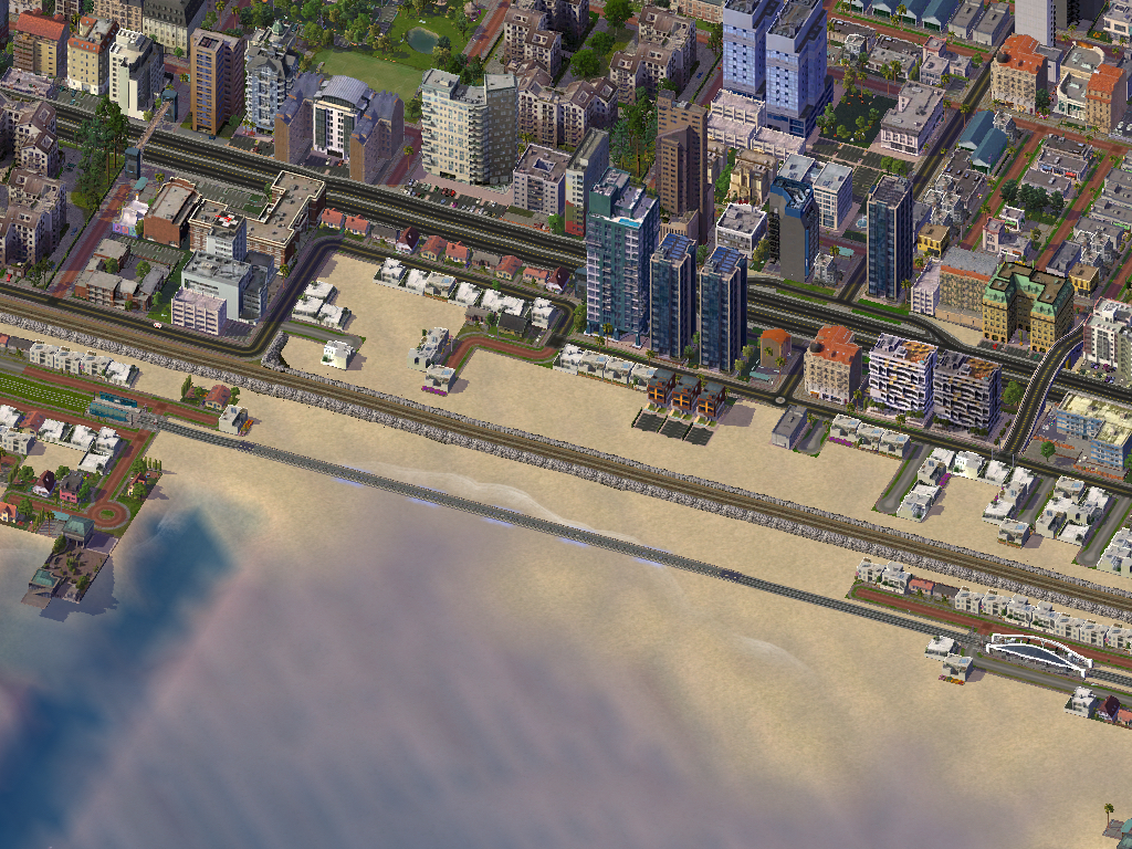
The Bahía Medusa causeway, running alongside the Coast Tram line –which crosses on a regular bridge
Tram and subway
There are two main tram lines in Bahía Medusa. The old Coast Tram (pictured above), designated as Tram Line 1, once crossed the entire island but nowadays starts at Shenzhen station in Anclaje. It has survived in its Bahía Medusa stretch and comes from the west, through the Old Town, turns north to avoid the bay, meets with the trains at BM Central, and then continues due east before dipping under the Airport Terminal 2 station complex. It used to then continue via a tunnel to Airport Terminal 1 Station, but the tunnel is now used by Subway Line 5.
Bahía Medusa also sees service from Tram Line 3, which runs through the entire length of Boulevard Due East, from Anclaje to Cabo Feliz. This 4-kilometer line is, perhaps, the most important transportation line in the city –and certainly one of the most attractive for tourists, since it cuts right through the city, is surrounded by greenery, yet passes right next to many tourist attractions.
As for subway, Line 1 was extended to the city in its early stages, as an Elevated Rail network that calls at BM Central, turns north to meet Tram Line 3, then turns east and continues to Cabo Feliz over Bay Avenue.
Line 4 finishes its arc trajectory in Bahía Medusa, coming from the northwest and turning due south to reach BM Central before turning west and finishing at Airport Terminal 1.
What is now known as Line 5 started as a Bahía Medusa-exclusive shuttle service from south to north, linking several stations near Highway 5. It was integrated into the Anclaje & Interior Subway, rerouted to turn northwest under Haussmann Avenue, then west under Bay Avenue (right where it meets Line 1). The line then continues on to Anclaje and Interior.
Monorail
The monorail developed as a convenient way to reach LFS Airport, but it quickly became a runaway success along its entire length. Both monorail lines start at Bahía Medusa, one heading north and the other, west.
Monorail Line A, the most used, crosses the entrance of the bay and then runs through the Old City, parallel to the Coast Tram, into Anclaje. Line B, on the other hand, goes north before turning to Interior.

The twin bridges over the bay, around the time LFS Airport was inaugurated. The highway bridge was recently replaced
Road transportation
Bahía Medusa has a comprehensive road transportation network, with two boulevards that continue from Anclaje, as well as Highway 2 and 6.
Highway 2 crosses the city from west to east on a straight line near the coast. Near the airport, Highway 6 branches off of it and heads north, parallel to Monorail Line B.
Boulevard Valenti, to the south, continues from Anclaje and heads to the airport via the Bay Entrance bridge (pictured above), while Boulevard Due East continues… well, east, and carries Tram Line 3 through the entirety of its length.
It's also worth mentioning Bay Avenue, which starts at the old town on a north-south direction, passes near BM Central and crosses under Highway 2 before turning east at the foothill of Medusa Hill (in the far northwest) and continuing in this direction, parallel to Boulevard Due East and Highway 2. It's the longest avenue in the entire city and it's soon going to be extended in Cabo Feliz.
Phew! That's about it for now. Next time, we'll talk about the many attractions of Bahía Medusa. See you then!
-
 6
6


0 Comments
Recommended Comments
There are no comments to display.
Sign In or register to comment...
To comment in reply, you must be a community member
Sign In
Already have an account? Sign in here.
Sign In NowCreate an Account
Sign up to join our friendly community. It's easy!
Register a New Account