

Region Overview

Region Maps
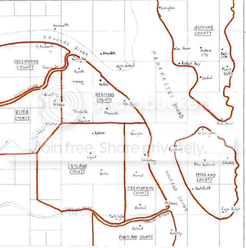
For my first non-intro page I decided to show you all some maps of my region that have been a work in progress along with the cities themselves. Unfortunatly, I know absolutely nothing about photoshop, so you all get to enjoy...my terrible hand-drawn maps I made on grid paper!!...cough...ok so first off:
Counties, Cities, Towns, and Villages
This first map shows county outlines in orange, with cities, towns and villages labeled, as well as some of the water features. The counties are as follows:
Trentonburg County
Hereford County
Portland County
River County
Greenwood County
Ashford County
Leyland County
Holland County
There are probably more to come as I expand the region outward. Within the towns, there are even smaller districts and hamlets which aren't shown in this map, but will be explained in more detail when we take a look at the individual cities.
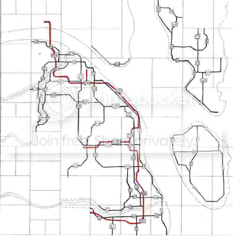
Highway Map
Ok so with that horribleness done, lets move on, what follows is a convoluded regional highway network, mostly state routes (in black) with the only interstate in the region so far, I-95 (and its spur, I-395) More often than not, the state highways make up the main street of whatever town they happen to pass through, which is very true to Northeastern US form.
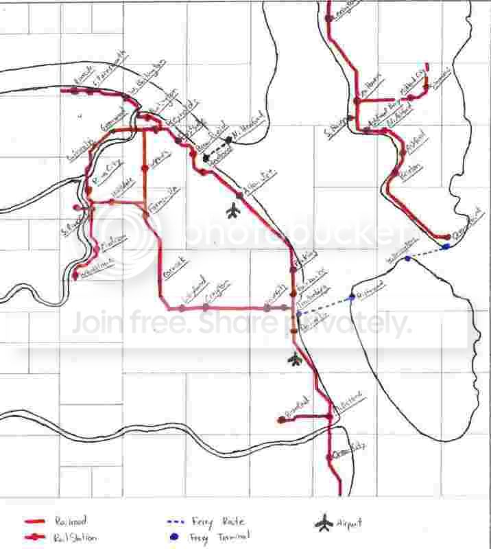
Rail and Ferry Map
Ok so 2 of 3 poorly scanned-in maps done. Lets get through this. The last map for today shows the intercity-railroad network in red. Note that no transit systems are shown here, only inter-city rail provided by Amtrak, Trentonburg Central Railroad, Norfolk Southern, and CSX Corp. Also of note are the blue dashed lines representing ferry routes across the bays and rivers that are too wide for bridges. Oh, and those wierd looking bird symbol things are supposed to be the airports in Trentonburg and Hereford County...
Yikes, these things scanned in very poorly, maybe I can fix those at some point, but by the next update, maybe we will get to see some actual pictures of the cities themselves.

3 Comments
Recommended Comments
Sign In or register to comment...
To comment in reply, you must be a community member
Sign In
Already have an account? Sign in here.
Sign In NowCreate an Account
Sign up to join our friendly community. It's easy!
Register a New Account