

Environmental Assessment (EA) of the Hurontario Corridor

Date: February 18, G.Y. 2
Please try to solve our meetings' problem, highlighted in pink towards the end of the meeting entry. Remember, people of Watersauga look up to you!
Counsellors,
Welcome to the 4th general meeting of the City of Watersauga Council. In our last entry, Counsellor ROFLYoshi has brought up many undoubtly interesting topics for us to investigate. However, we will put that topic aside for now, and will be discussed in the next meeting instead. As promised, we will continue to investigate the potential ecological impact of the developments along the corridor.
Taking some of your considerations, we have established yet another new community just north of the current urban fringe. The farm owner agreed to sell us the land, and construction has immediately begin. The area is currently home to about 5,000 people.
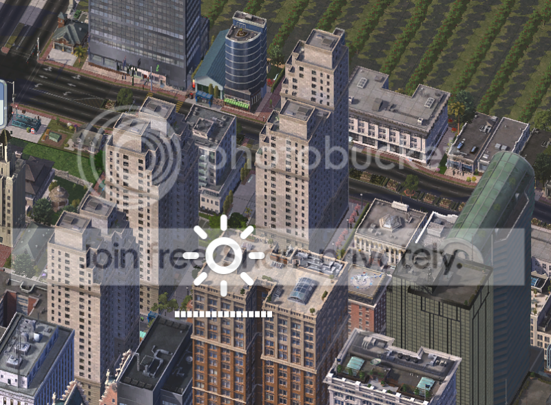
Figure 1 - (Sorry for the brightness icon, I accidentally press it while taking a screenshot). The lower density towards the upper left was from the former developments of the hamlet of Courners. The hamlet no longer exists, as much of it has been demolished. The Bullock Subway Line (this is not an intercity / regional development corridor, and will be discussed later, but certainly a major corridor within the city) has been extended north and added 2 stops.
The new community is built based on the SMART growth concept, and is almost entirely transit-powered. Schools, and other ammenities are designed so they can reached by walking.
Much of Watersauga is located on a piece of lower-elevated flat piece of land. Towards the north, away from Pacific Ocean, the land gradually rises up, and thus therefore home to many precious forest tracts / woodlots, which is extremely (and I can't emphasize that enough) of the local wildlife. The area is home to many species of wildlife, some of them are endangered, and some of them only exist within the Watersauga boundaries. As a result, we would have to be careful with our developments and not to destroy them.
We have woodlots set aside in urban areas, appealing to the wildlife. These areas are never to be developed to protect the wildlife. We will discuss the location of these in our next entry.
Last time, we only took a look at the corridor's southern end in Old Watersauga. Let us finish up our tour towards the north.
Along Hurontario Avenue, we can find:

Figure 2 - Immediately north of the City of Old Watersauga, is an area of high-tech industrial park. They primarily exist in low to medium density, and will be slowly converting to higher density in the future. About 100,000 industrial jobs are available here. The dirty industrial jobs are pre-100 G.Y. era (i.e. over a century old) when the city has just begun.

Figure 3 - North of the industrial area, Hurontario formerly ends here, at around the 10th concession counting from the Pacific Ocean shoreline. Given this corridor plan, we extended Hurontario Avenue north towards Elgin Mills (the northern end of the corridor). The extension was built in a ground highway format, to accomodate future growths.
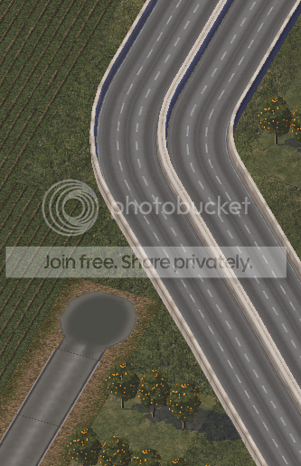
Figure 4 - The street you see in the lower left corner is the former alignment of Old Hurontario Avenue. Notice how the new highway overtakes the old alignment to maintain the concession system. The old alignment is not a gravel road as it was paved when it was built. Other rural roads, however, are gravel roads (Old Hurontario Avenue is an exception).
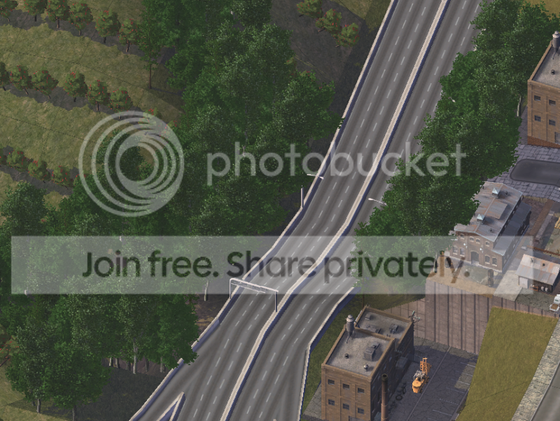
Figure 5 - The highway travels through an ecological sensitive valley. Upon construction of the highway, we received many complaints in regards to concern of the local wildlife. Guardrails are proposed to be installed in the area. We have also maintained a small woodlot in the locale. Yet, many wildlife can still be found on the highway, and as a result, many animal deaths are recorded on this section of the highway. To the right, it is a series of manufacturing industries. They are under the regulation of Clean Air Act to ensure the wildlife is protected.
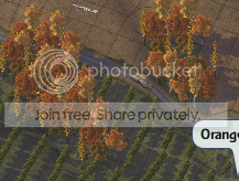
Figure 6 - Another example of woodlots. (There are bigger ones, of course) Notice the rugged landscape. The landscape gets hillier as we reach north.
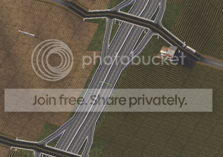
Figure 7 - Many people question about the new highway. It seems to be empty during non-rush hours. It is only used by mainly (up to 90%) freight trucks, and only a few scarce cars passing by a day travelling between the two major cities of the corridor.
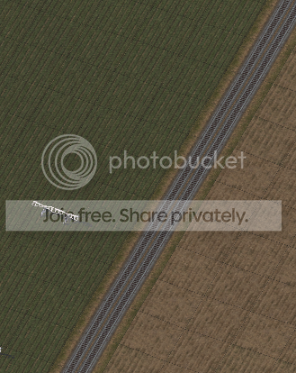
Figure 8 - Future rail alignments are built for future rail usage. For now, a few passenger trains and freight trains use the alignment.
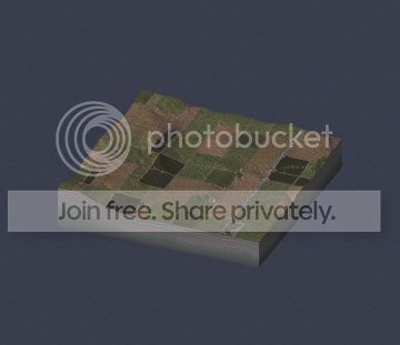
Figure 9 - The remote Outpost of MacKenzie Ridges (Outpost is a form of municipality in our region, among Townships and Towns). MacKenzie Ridges is inhabited. Patches of areas are reserved for woodlots. Farms are positioned here to prepare for future developments.
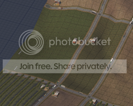
Figure 10 - Our solution: Smaller farmland size. More agricultural jobs spanning over a smaller area of land. More effects over a small area of land means more wildlife is protected.
Most of our agricultural spaces are specifically positioned away from Dawson River. The reason is, the wildlife enjoys living around water. We have reserved over 4 medium sized-tiles for the wildlife, with occasional county roads passing through this area. Heavy trucks are not permitted to use the roads. The roads are also closed in the winter months. This is a significant obstacle to our development of the corridor.
Conclusion of the EA
The Hurontario Planning Corridor fails the environmental assessment. Better solutions are needed before developments can go ahead.
According to the Law of the City of Watersauga, a fail in EA requires the locale to halt all developments. We have to figure this out in order to start the development again.
Problem 2 -
So Counsellors. How can we balance growth of the corridor and nature? It seems like we have to sacrafice one or the other. While we had a smaller farmland size, so farms don't spread over a big area, do you have any other ideas in mind that we can use?
SOLUTIONS AND CONSTRUCTIVE COMMENTS ARE APPRECIATED! THANKS!
That's it for the 4th meeting! Please be prompt for the next meeting!
Regional Chair
Next Up: As the Highway Gets Closer to Elgin Mills... >>
-----------------
P.S. Oh no, you guys can actually start rating me from the next entry. Please don't judge me on the graphics, please! Thanks all!
You can start telling me how to improve this CJ... I want to get a high rating for the CJ... 

3 Comments
Recommended Comments
Sign In or register to comment...
To comment in reply, you must be a community member
Sign In
Already have an account? Sign in here.
Sign In NowCreate an Account
Sign up to join our friendly community. It's easy!
Register a New Account